


Geosun gAirHawk Series GS-100V LiDAR Scanning System HESAI XT16 Laser Sensor Built-In Camera High Precision Aerial Scan

Contact Person : Lanbooxie
Phone Number : +86 15527360208
WhatsApp : +8615527360208


| Minimum Order Quantity : | 1 | Price : | Negotiation |
|---|---|---|---|
| Packaging Details : | Suit Case 450*365*200 mm | Delivery Time : | 15-20 works days |
| Payment Terms : | T/T, L/C, Western Union |
| Place of Origin: | China | Brand Name: | Geosun |
|---|---|---|---|
| Certification: | CE,ISO | Model Number: | GS-100G |
|
Detail Information |
|||
| Material: | Aluminum Alloy Body | Dimension: | 17.2*10.6*38.9cm |
|---|---|---|---|
| Weight: | 1.8kg | Storage: | 64GB Max Support 128GB TF Card |
| Working Temperature: | -20°~+55° | Carrying Platform: | Handheld,Multi-Rotor And Vehicle |
| Processing Software: | GPointsCreator | ||
| High Light: | GS-100G LiDAR Scanning System,Mapping LiDAR Scanning System,3D Data Collection LiDAR System |
||
Product Description
Geosun GFireEye Series GS-100G LiDAR Scanning System HESAI XT16 Slam Algorithms Under Ground Mapping 3D Data Collection
Geosun gFireEye Series GS-100G LiDAR Scanning System
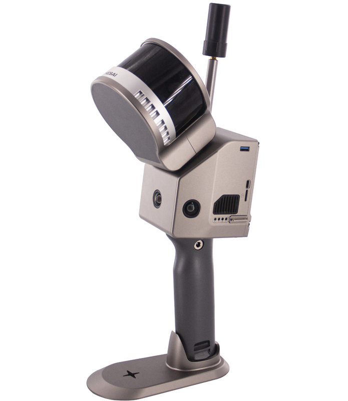
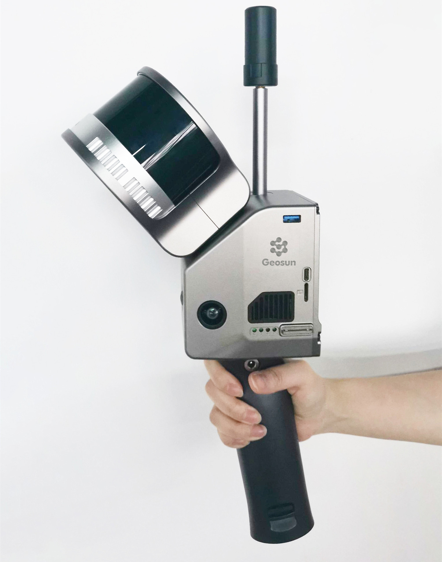
GS-100G is a kind of handheld LiDAR scanning system independently developed by Geosun company.It adopts a simple design with a small body, so as to be light to carry, easy to operate and flexible to install.With a variety of sensors, it can quickly capture a wide range of scene data, support multi-platform and multi-mode operation, and combine GNSS, INS, LiDAR and SLAM algorithms to achieve seamless survey of indoor and outdoor scenes.
Specification of LiDAR Scanning System gAirHawk GS-100G
|
System Parameter |
|
|
Point Cloud Accuracy |
5cm@100m without control point |
|
Weight |
1.8kg(withth battery) |
|
Battery Parameter |
4.2V 3400mAh |
|
Storage |
Build-in Flash memory 64GB, Support microSD 256GB. |
|
Voltage Range |
12V-18V |
|
Dimension |
17.2*10.6*38.9cm |
|
Working Temperature |
-20℃-55℃ |
|
Carrying Platform |
Hand-held, Multi-rotor and Vehicle |
|
System Consumption |
25W |
|
POS Unit |
|
|
Model |
gSpin 210 |
|
Update Frequency |
200Hz |
|
GNSS Signal Type |
GPS L1/L2/L5, GLONASS L1/L2 BDS B1C/B1/B2/B2a/B2b/B3 GALELEO E1/E5b/E5a |
|
Position Accuracy |
Horizonal 0.02m Elevation 0.03m |
|
Pitch Accuracy |
0.015° |
|
Roll Accuracy |
0.015° |
|
Heading Accuracy |
0.040° |
|
Laser Unit |
|
|
Detection Range |
80m@10%,Max Range 120m |
|
Range Accuracy |
士1.5cm |
|
Channel |
16 |
|
Horizontal FOV |
360° |
|
Vertical FOV |
270° |
|
Points Rates |
Single echo 320,000 Points/Sec, Dual echo 640,000 Points/Sec. |
|
Camera Parameter |
|
|
Resolution |
3*5 MP |
|
FOV |
Horizontal 270° |
|
Shooting Mode |
Isochronous |
Application of LiDAR Scanning System gAirHawk GS-100G
![]()
Package LiDAR Scanning System gAirHawk GS-100G
LiDAR Scanning System gAirHawk GS-100G is packed by suit case with EVA material liner inside, then covered by hard carton box. It is suitable for air shipment and sea shipment.
![]()
![]()
Enter Your Message
| Wuhan Geosun Navigation Technology Co., Ltd |
| 4F, Building D, Tianyi plaza No.8 West Maodianshan Road, East Lake Hi-tech Zone Wuhan City, China |
| +86--15527360208 |
| sales@geosunlidar.com |