


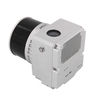
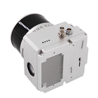
EU Airborne UAV LiDAR Scanning GS-130X Hesai XT32 Laser Senor High Accuracy Pos Colored Point Cloud

Contact Person : Lanbooxie
Phone Number : +86 15527360208
WhatsApp : +8615527360208


| Minimum Order Quantity : | 1 | Price : | Negotaible |
|---|---|---|---|
| Packaging Details : | Suit case 450*365*200 mm | Delivery Time : | 7-10 work days |
| Payment Terms : | T/T, Western Union | Supply Ability : | 30 sets/month |
| Place of Origin: | China | Brand Name: | Geosun |
|---|---|---|---|
| Certification: | CE, ROHS | Model Number: | GS-130X UAV LiDAR Scanning System |
|
Detail Information |
|||
| Item Name: | Drone LiDAR Scanning System | Operation Efficiency: | 1.6 K㎡ / Single Flight |
|---|---|---|---|
| Application: | Topography, Forestry, Powerline, Smart City | Channel: | 32-channel |
| Material: | Aluminum Alloy Body | Accuracy: | 10cm@100m |
| Dimension: | 14.4*10.9*12cm | Weight: | 1.26kg |
| Storage: | 64GB Max Support 128GB TF Card | Working Temperature: | -20°~+55° |
| Carrying Platform: | Multi-Rotor/VTOL | Trajectory Software: | Shuttle |
| Point Cloud Software: | GAirHawk | ||
| High Light: | Aerial Surveying UAV LiDAR System,GS-130X UAV LiDAR System,Terrain Mapping UAV LiDAR System |
||
Product Description
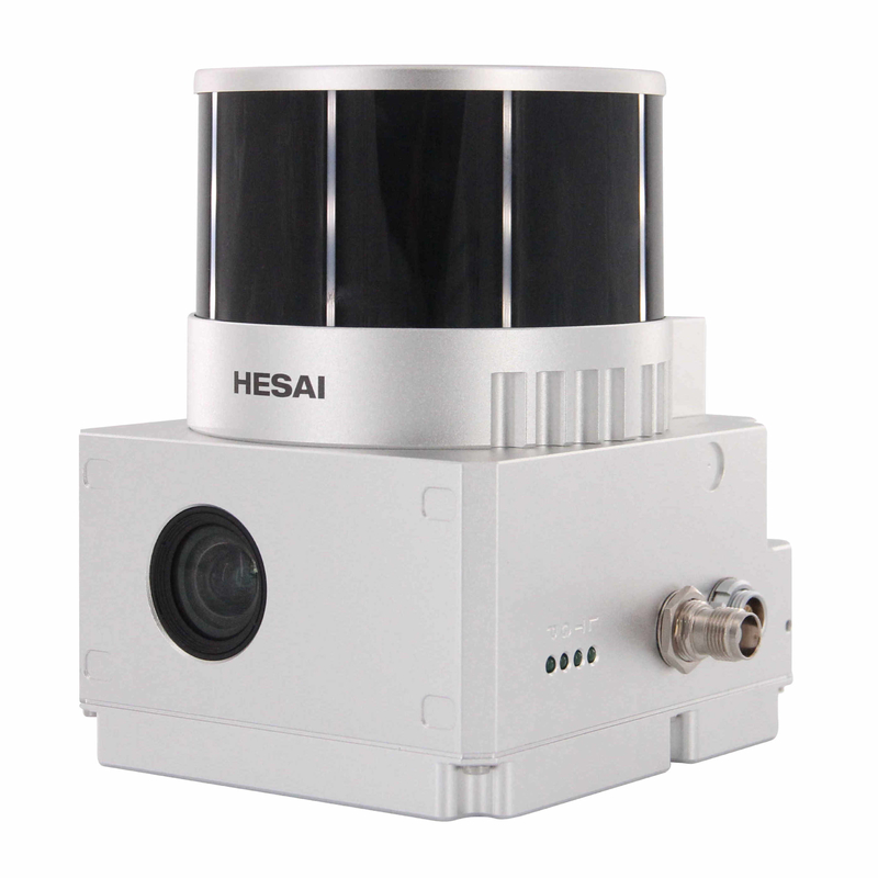
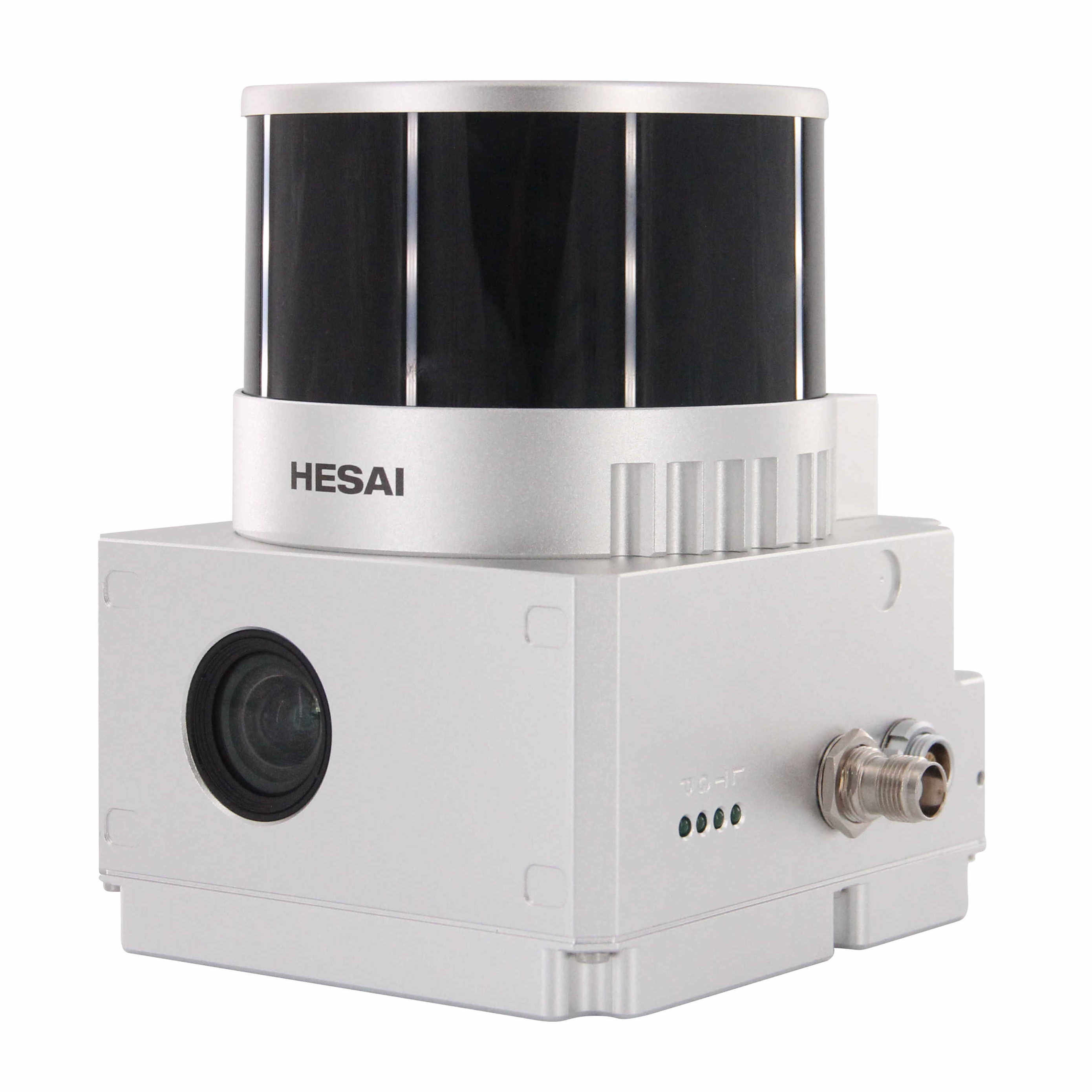
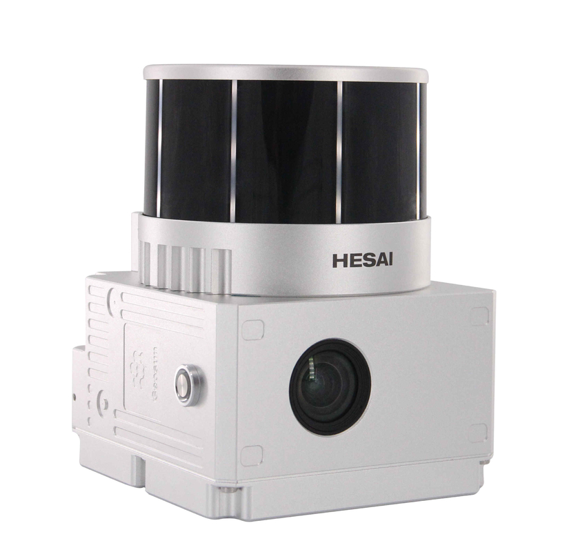
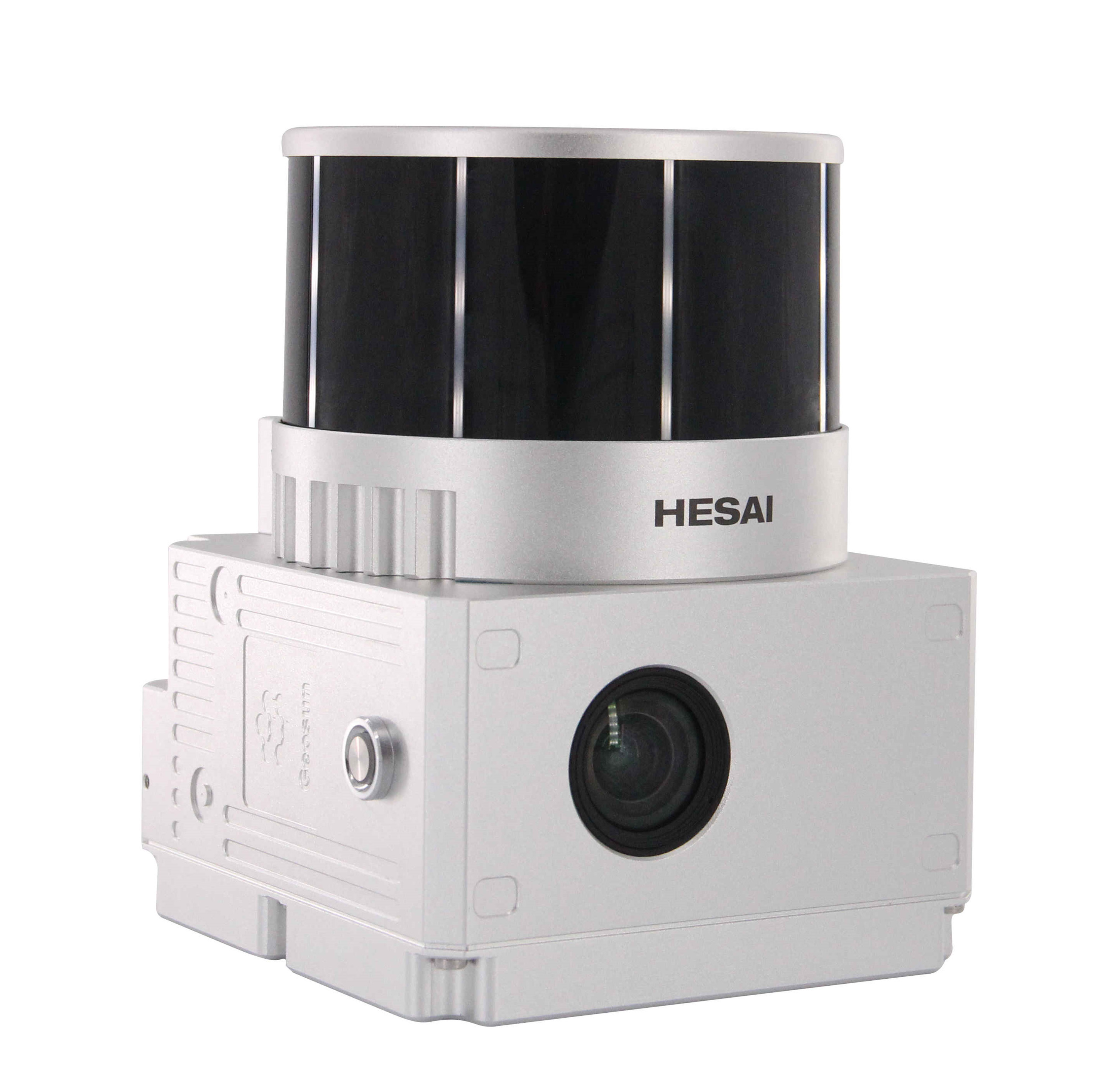
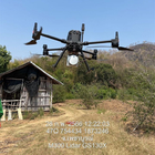
Terrain Mapping Aerial Surveying Geosun UAV LiDAR GS-130X High Precision Cost-Effective Cost Highly Integration
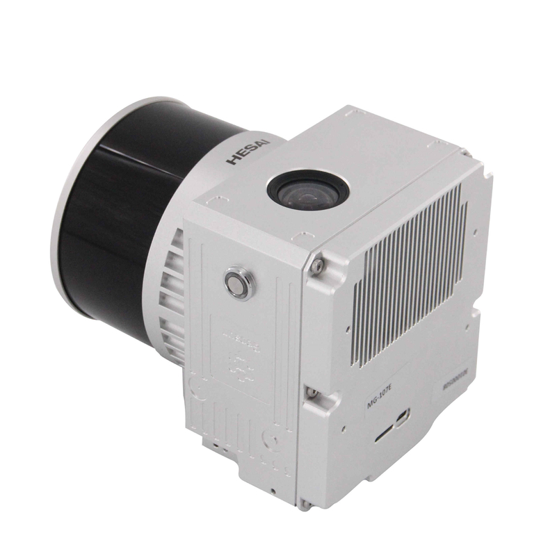
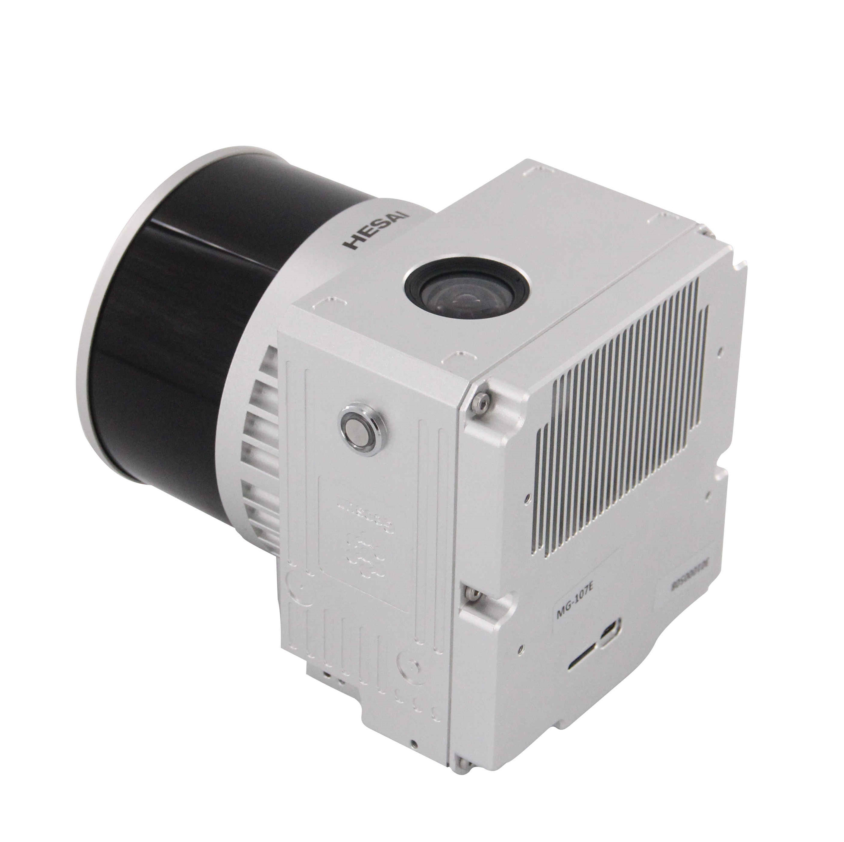
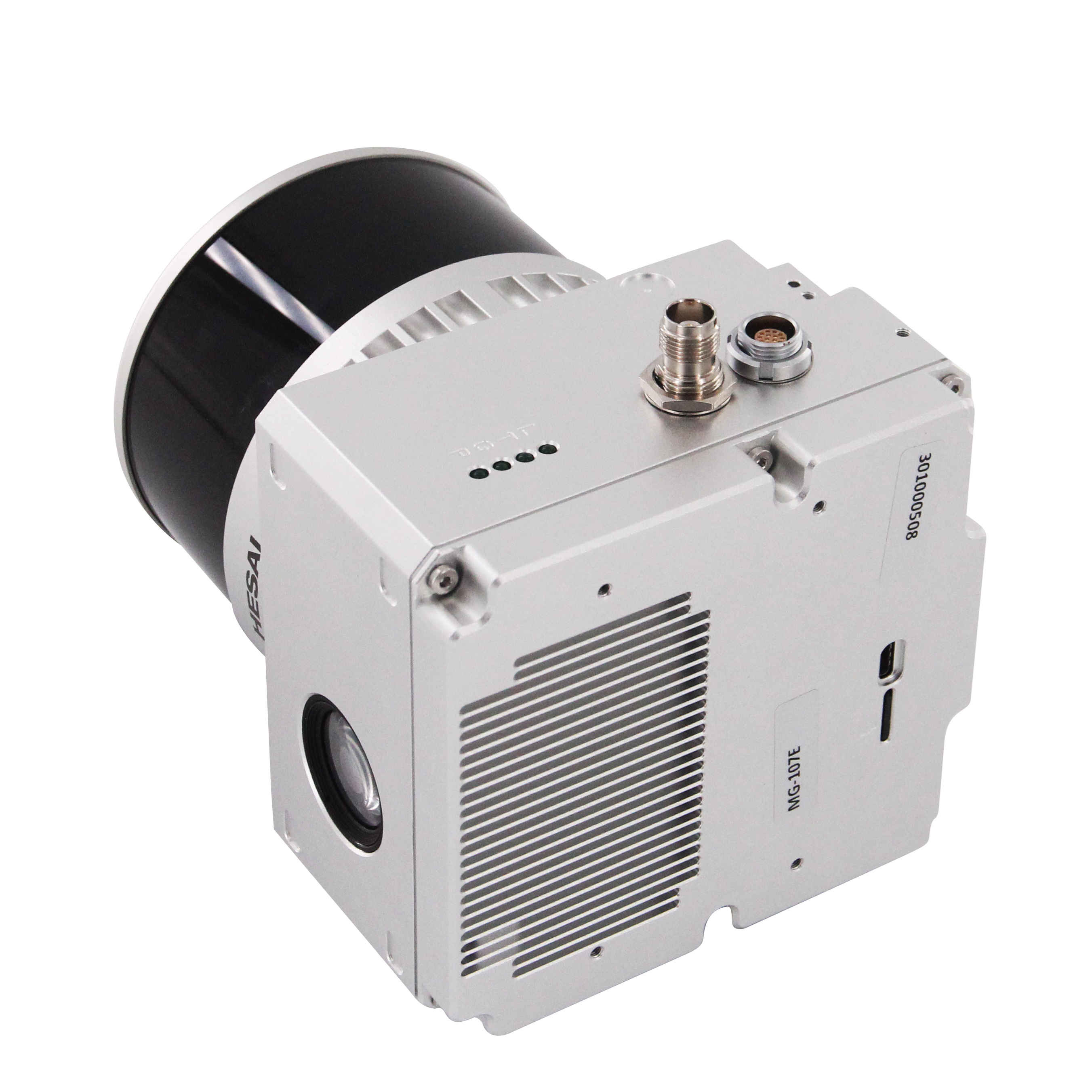
Geosun gAirHawk Series GS-130X UAV LiDAR Scanning System
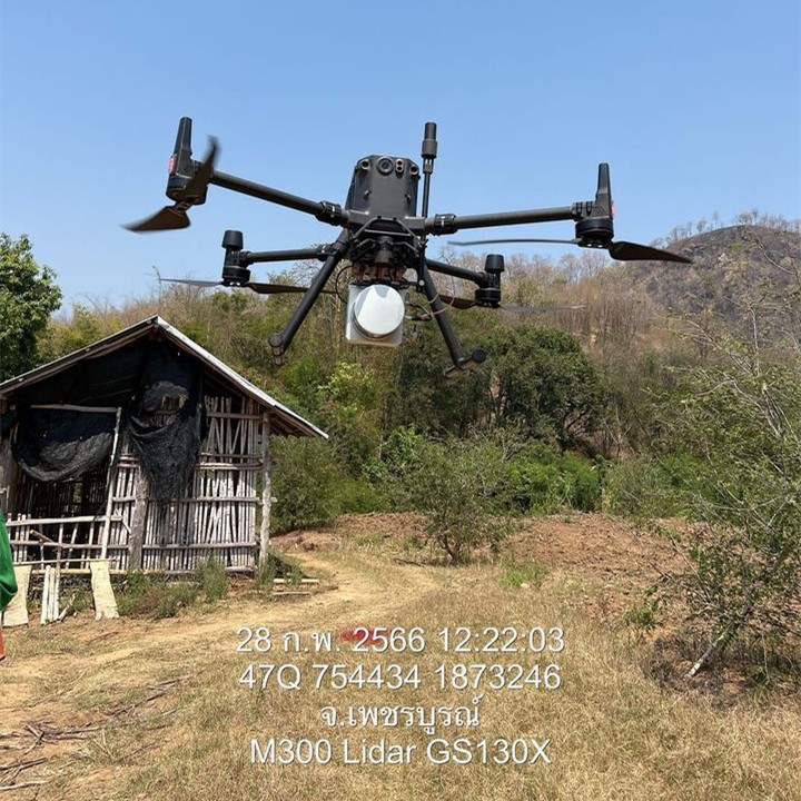
Application of GS-130X UAV LiDAR Scanning System
UAV LiDAR GS-130X is used to do forestry mapping in Thailand.
![]()
![]()
![]()
![]()
Free trial software of GS-130X UAV LiDAR Scanning System
Free trial test, achieve high precision
The Guideline of LiDAR Usage and Reference.pdf
Point Cloud Pre-Processing Software Integrated With Trajectory Processing----Geosun Self-developed gAirHawk 5.0
Key Features of gAirHawk 5.0 Software
1. Raw data: intelligently load
2. Four default coordinates
3. Point cloud Optimization
4. Start and stop calculation
![]()
![]()
Specification of GS-130X UAV LiDAR Scanning System
|
|||||||||||||||||||||||||||||||||||||||||||||||||||||||||||||||||
Package of GS-130X UAV LiDAR Scanning System
GS-130X UAV LiDAR Scanning System is packed by suit case with EVA material liner inside, then covered by hard carton box.
The package of UAV LiDAR Scanning System is suitable for air shipment and sea shipment.
![]()
![]()
Enter Your Message
| Wuhan Geosun Navigation Technology Co., Ltd |
| 4F, Building D, Tianyi plaza No.8 West Maodianshan Road, East Lake Hi-tech Zone Wuhan City, China |
| +86--15527360208 |
| sales@geosunlidar.com |