


EU Airborne UAV LiDAR Scanning GS-130X Hesai XT32 Laser Senor High Accuracy Pos Colored Point Cloud

Contact Person : Lanbooxie
Phone Number : +86 15527360208
WhatsApp : +8615527360208

| Minimum Order Quantity : | 1 | Price : | Negotiation |
|---|---|---|---|
| Packaging Details : | Suit case 450*365*200 mm | Delivery Time : | 10-15 works days |
| Payment Terms : | T/T | Supply Ability : | 30 sets/month |
| Place of Origin: | China | Brand Name: | Geosun |
|---|---|---|---|
| Certification: | CE,ISO | Model Number: | GS-100V UAV LiDAR Scanning System |
|
Detail Information |
|||
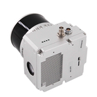
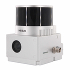
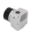
| Weight: | 1.4kg | Dimension: | 14.2*10.9*12cm |
|---|---|---|---|
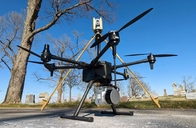
| Storage: | 64GB Max Support 128GB TF Card | Carrying Platform: | Vehicle/Multi-Rotor/VTOL |
| High Light: | GS-100V UAV LiDAR System,360 Degree Fov LiDAR System,64GB UAV LiDAR System |
||
Product Description
Aerial Mapping GS-100V UAV LiDAR Scanning System 360 Degree Fov Laser Sensor Colored Point Cloud Free Software
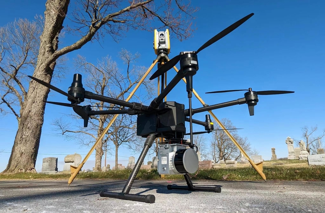
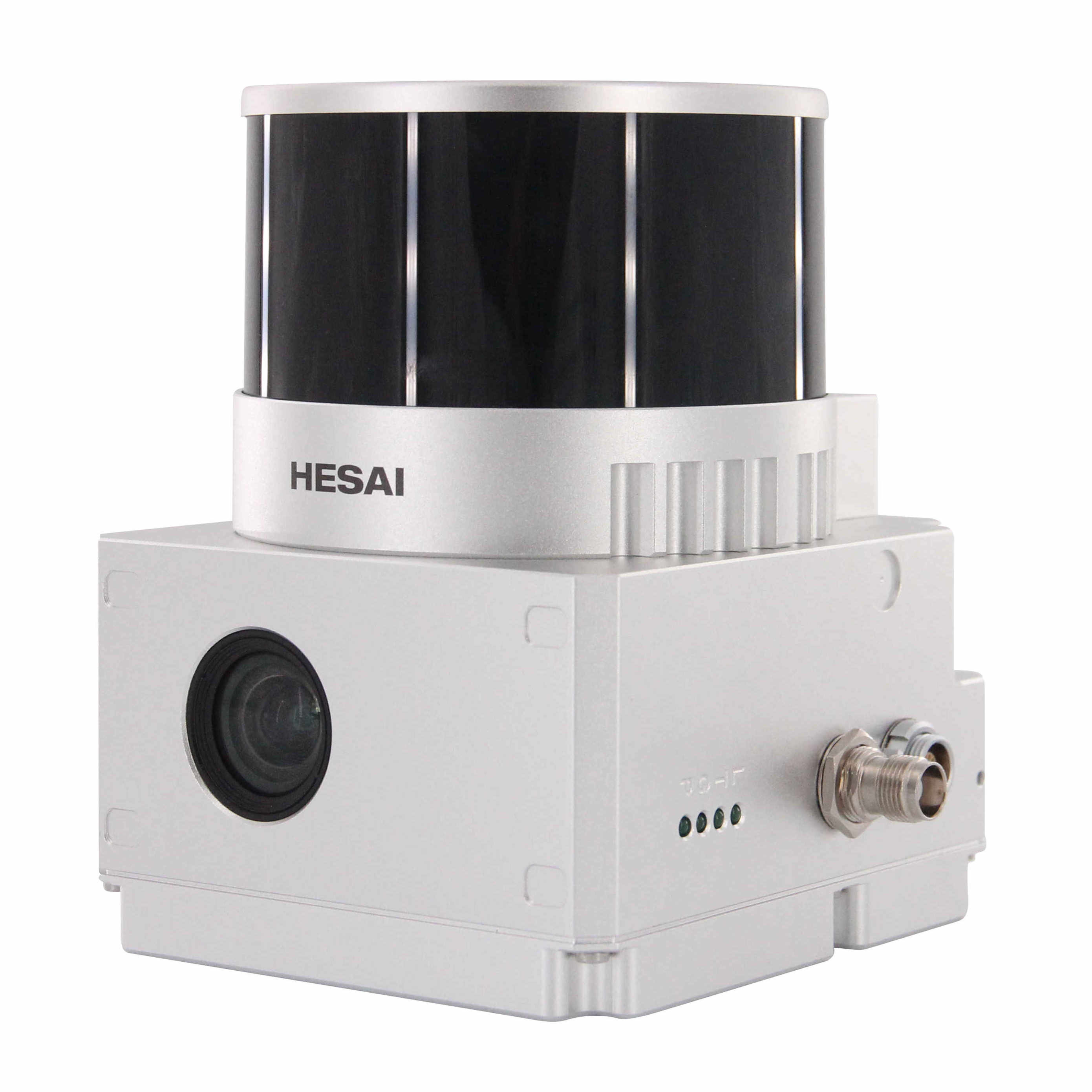
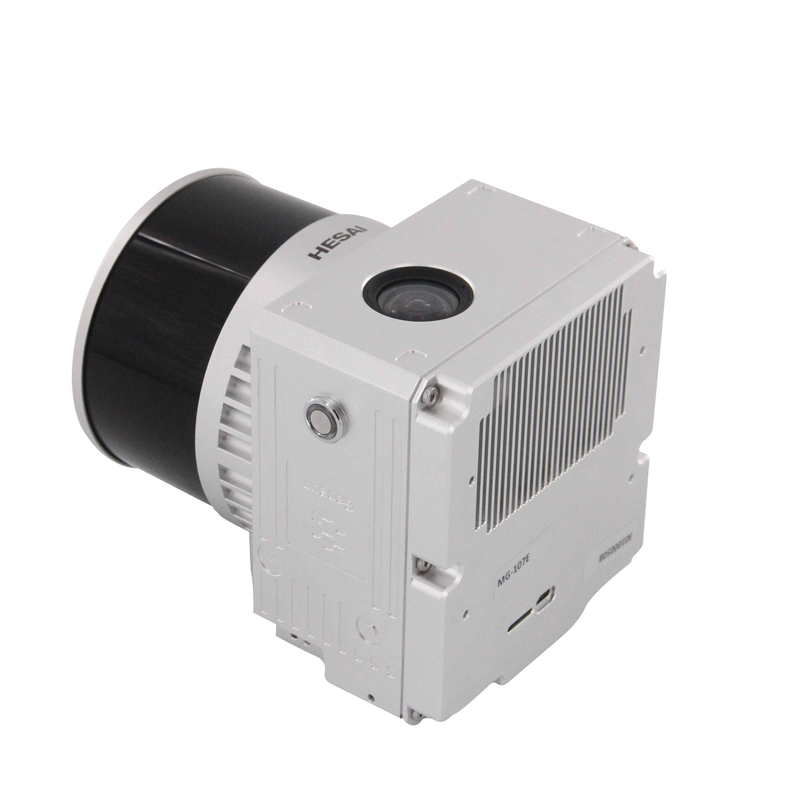
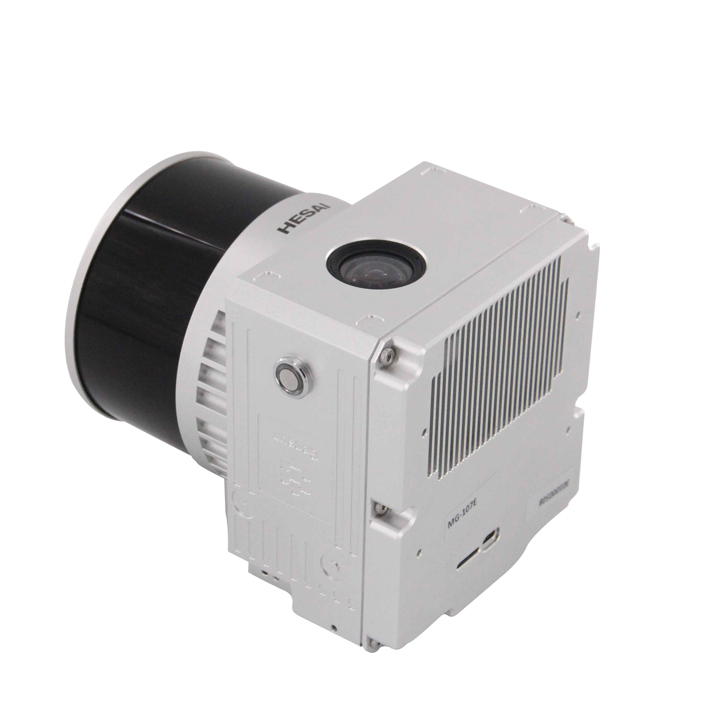
Geosun gAirHawk LiDAR Scanning System GS-100V
gAirHawk GS-100V is a kind of short-range, compact LiDAR point cloud data acquisition system, integrated HESAI XT16 laser scanner, GNSS and IMU positioning and attitude determination system, and storage control unit, is able to real-time, dynamically, massively collect high-precision point cloud data and rich image information. It is widely used in the acquisition of 3D spatial information in surveying, electricity, forestry, agriculture, land planning.
Specification of UAV LiDAR Scanning System gAirHawk GS-100V
|
|||||||||||||||||||||||||||||||||||||||||||||||||||||||||||||||
Application of UAV LiDAR Scanning System gAirHawk GS-100V
GS-100V LiDAR and GS-850 UAV in the United States, based on high-quality LAS data, using PCA4.2 software for point cloud post-processing, single wood segmentation, point cloud automatic classification, DEM production.
![]()
![]()
![]()
![]()
![]()
![]()
Free Trial Software UAV LiDAR Scanning System gAirHawk GS-100V
Free trial test, achieve high precision
The Guideline of LiDAR Usage and Reference.pdf
Point Cloud Pre-Processing Software Integrated With Trajectory Processing----Geosun Self-developed gAirHawk 5.0
Key Features of gAirHawk 5.0 Software
1. Raw data: intelligently load
2. Four default coordinates
3. Point cloud Optimization
4. Start and stop calculation
![]()
![]()
Package of UAV LiDAR Scanning System gAirHawk GS-100V
UAV LiDAR Scanning System gAirHawk GS-100V packed by suit case with EVA material liner inside, then covered by hard carton box. It is suitable for air shipment and sea shipment.
![]()
![]()
Enter Your Message
| Wuhan Geosun Navigation Technology Co., Ltd |
| 4F, Building D, Tianyi plaza No.8 West Maodianshan Road, East Lake Hi-tech Zone Wuhan City, China |
| +86--15527360208 |
| sales@geosunlidar.com |