


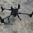
EU Airborne UAV LiDAR Scanning GS-130X Hesai XT32 Laser Senor High Accuracy Pos Colored Point Cloud

Contact Person : Lanbooxie
Phone Number : +86 15527360208
WhatsApp : +8615527360208


| Minimum Order Quantity : | 1 | Price : | Negotiation |
|---|---|---|---|
| Packaging Details : | Suit Case 450*365*200 mm | Delivery Time : | 10-15 works days |
| Supply Ability : | 80 SETS/Month |
| Place of Origin: | China | Brand Name: | Geosun |
|---|---|---|---|
| Certification: | CE,ISO | Model Number: | GS-100C+ |
|
Detail Information |
|||
| Item Name: | LiDAR Scanning System | Operation Efficiency:: | 1.92 Km2 / Single Flight |
|---|---|---|---|
| Application: | Topography, Smart City | Numbers Of Returns: | Triple-echo |
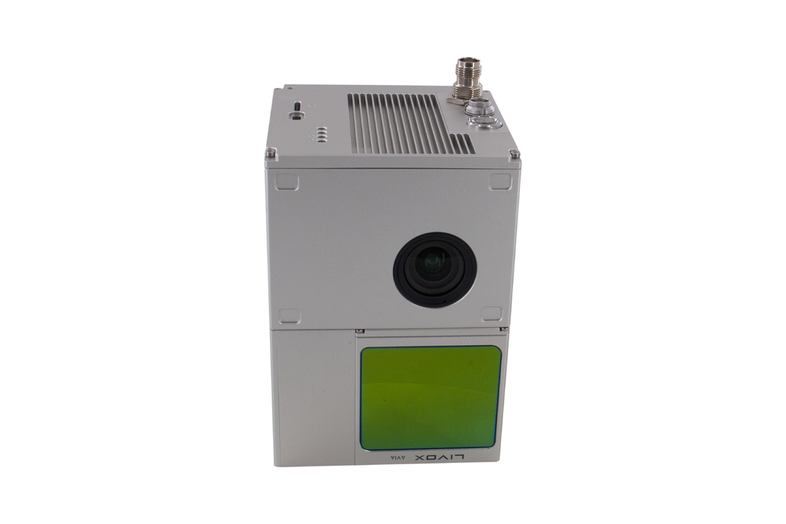
| Accuracy: | 10cm@100m | Dimension: | 13.8*9.1*9.4cm |
| Weight: | 1015g | Storage: | 64GB Max Support 128GB TF Card |
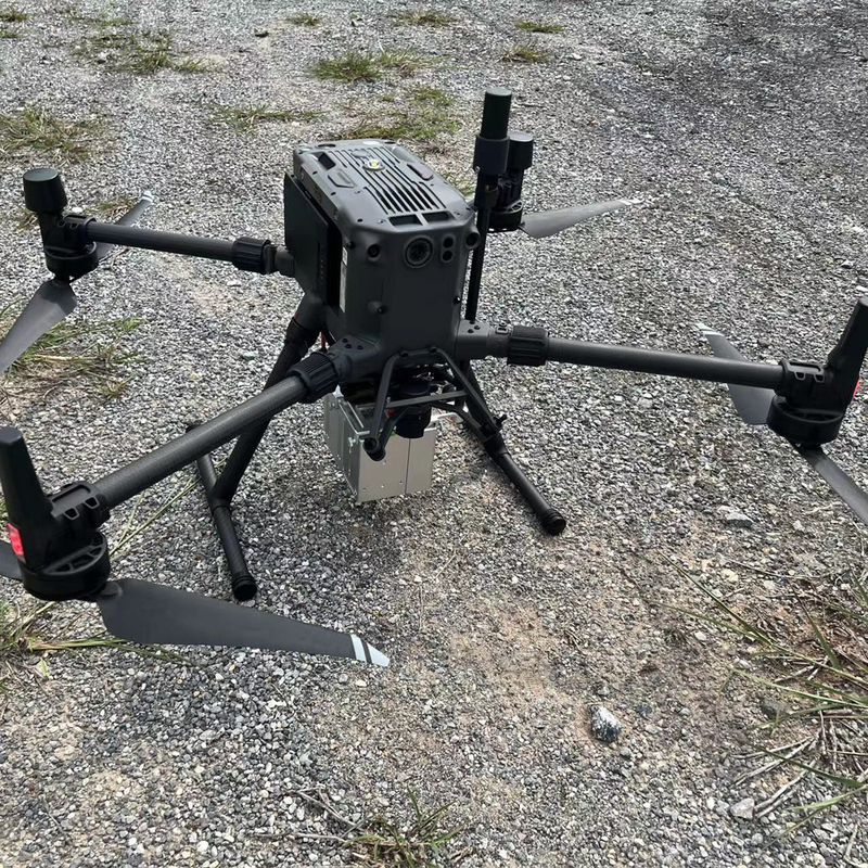
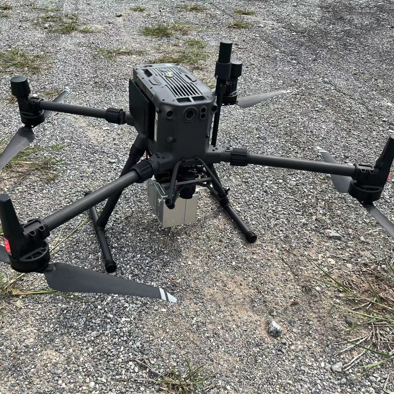
| Working Temperature: | -20°~+55° | Carrying Platform: | Multi-Rotor/VTOL |
| Trajectory Software: | Shuttle | Point Cloud Software: | GAirHawk |
| High Light: | LiDAR Drone Scanner Geosun,GS-100C+ LiDAR Drone Scanner,High Precision lidar 3d scanner |
||
Product Description
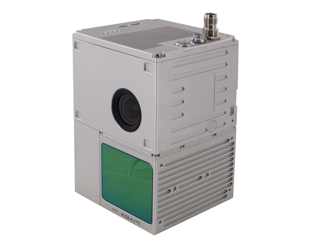
Geosun Thailand partner have a on-site trainning at university for uav LiDAR scanning system GS-100C+.
uav LiDAR scanning system GS-100C+ is the most affordable uav lidar scanning system choice to start aerial mapping because of its full function.
The most popular laser sensor Livox avia, high accuracy IMU and built-in RGB camera work together for excellent performance on different applications of surveying.
![]()
![]()
![]()
Free Trial Software UAV LiDAR Scanning System
Trial Software Information.pdf
Point Cloud Pre-Processing Software Integrated With Trajectory Processing----Geosun Self-developed gAirHawk 5.0
Key Features of gAirHawk 5.0 Software
1. Raw data: intelligently load
2. Four default coordinates
3. Point cloud Optimization
4. Start and stop calculation
Free trial test, achieve high precision
![]()
![]()
Specification of UAV LiDAR Scanning System
| uav LiDAR scanning system gAirHawk GS-100C+ | ||
| Item Name | System Parameter | |
|
Parameter |
Weight | 1025g |
| Measuring accuracy | Less than 10 cm (110 m AGL) | |
| Power range | 12V~16V | |
| Working temperature | -20℃~+55℃ | |
| Consumption | Average 20W | |
| Support Platform | Multi Rotor, VTOL Fixed Wing | |
| Storage | 64 GB storage, maximum support 128GB TF card | |
|
Lidar Unit
|
Laser Model | Livox Avia |
| Measuring Range | 190m@10% Reflectivity | |
| Laser class | 905nm Class1 (IEC 60825-1:2014) | |
| Laser line number | Equivalent to 64-beam | |
| Mix. range | 0.3 M | |
| Range Precision | 2 cm | |
| data | Triple echo, 720,000 Points/Sec | |
| FOV | 70° the circular view | |
| POS Unit | Update frequency | 200HZ |
| Heading accuracy | 0.040° | |
| Pitch accuracy | 0.015° | |
| Rolling accuracy | 0.015° | |
| Position accuracy | 0.02 - 0.05m | |
| GNSS signal type | GPSL1/L2/L5 GLONASSL1/L2 BDS B1/B2/B3 GAL E1/E5a/5b | |
| Pre-processing software | POS software | Output information: position, speed, attitude |
| Point cloud software | Output point cloud data format: LAS format, custom TXT format | |
| Built-in Camera | FOV | 83 Degree |
| Effective Pixel | 26 Mega Pixel | |
| Focal Lenght(mm) | 16 | |
UAV LiDAR Scanning System is packed by suit case with EVA material liner inside, then covered by hard carton box.
The pacakge of uav LiDAR scanning system is suitable for air shipment and sea shipment.
![]()
![]()
Enter Your Message
| Wuhan Geosun Navigation Technology Co., Ltd |
| 4F, Building D, Tianyi plaza No.8 West Maodianshan Road, East Lake Hi-tech Zone Wuhan City, China |
| +86--15527360208 |
| sales@geosunlidar.com |