


EU Airborne UAV LiDAR Scanning GS-130X Hesai XT32 Laser Senor High Accuracy Pos Colored Point Cloud

Contact Person : Lanbooxie
Phone Number : +86 15527360208
WhatsApp : +8615527360208


| Minimum Order Quantity : | 1 | Price : | Negotiation |
|---|---|---|---|
| Packaging Details : | Suit Case 520*420*230 mm | Delivery Time : | 45-60 works days |
| Payment Terms : | T/T, Western Union | Supply Ability : | 30 SETS/Month |
| Place of Origin: | China | Brand Name: | Geosun |
|---|---|---|---|
| Certification: | CE, ISO | Model Number: | GS-260R uav LiDAR Scanning System |
|
Detail Information |
|||
| Laser Sensor: | Riegl | Detection Range: | 230m AGL |
|---|---|---|---|
| Accuracy: | 1 Cm | Application: | Power Line |
| High Light: | Geosun Middle Range UAV LiDAR System,230m AGL Riegl UAV LiDAR,230m AGL UAV LiDAR System |
||
Product Description
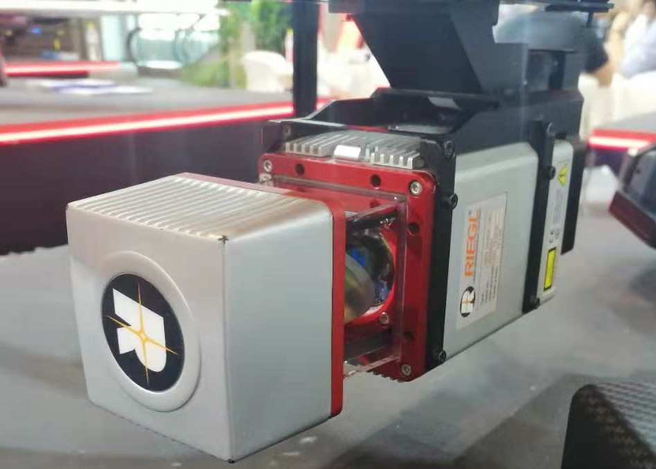
gAirHawk GS-260R UAV LIDAR SCANNING SYSTEM
UAV LiDAR Scanning System with Middle Range Riegl Sensor
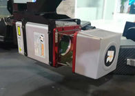
gAirHawk GS-260R is a kind of long range, compact LiDAR point cloud data acquisition system, integrated Riegl laser scanner, GNSS and IMU positioning and attitude determination system, and storage control unit, is able to real-time, dynamically, massively collect high-precision point cloud data and rich image information. It is widely used in the acquisition of 3D spatial information in surveying, electricity, forestry, agriculture, land planning.
The RIEGL VUX-1UAV
is an extremely lightweight airborne laser scanner, designed specifically for integration with UAS/UAV/RPAS.
The small and sophisticated design of the stable aluminum housing offers various integration possibilities with platforms that offer restricted space or payload capabilities. The 360° field of view allows complete acquisition of the environment.
An easy-to-remove SD card for data storage, and/or the option for streaming the scan data via LAN-TCP/IP interface, in combination with the modest power consumption of the scanner, enable straight-forward integration with most UAS/UAV/RPAS types.
The RIEGL miniVUX-1UAV makes use of RIEGL’s unique Waveform-LiDAR technology, allowing echo digitization and online waveform processing. Multi-target resolution is the basis for penetrating even dense foliage. As a further special feature, the wavelength is optimized for the mea-surement of snowy and icy terrain.
In addition to the stand-alone version of the miniVUX-1UAV, RIEGL also offers fully-integrated system solutions.
Feature
Very compact & lightweight (1.55 kg / 3.4 lbs)
360° field of view
Robust aluminium housing, ready to be mounted on multi-rotor, rotary-wing, and fixed-wing UAVs
makes use of RIEGL’s unique echo signal digitization and online waveform processing
Multiple target capability – up to 5 target echoes per laser shot
Scan speed up to 100 scans/sec
Measurement rate 100,000 measurements/sec
Mechanical and electrical interface for IMU mounting
Exceptionally well suited to measure snowy and icy terrain
user-friendly, application- and installation-oriented solutions for integration
Specification
| gAirHawk GS-260R | ||
| Item Name | System Parameters | |
|
Parameters |
Weight | 2.9 kg (without camera) |
| Measuring accuracy | 0.1m/0.05m(@150m) | |
| Working temperature | -20℃~+60℃ | |
| Power range | 12 V- 24 V | |
| Consumption | 16 W | |
| Carrying Platform | M600 PRO | |
| Storage | 64 GB storage, maximum support 128GB TF card | |
|
Lidar Unit
|
Measuring Range | 170m@20% Reflectivity, 290m@60% Reflectivity, |
| Laser class | 905nm Class1 (IEC 60825-1:2014) | |
| Laser line number | Single-Beam | |
| Max. range | 1350 m | |
| Mix. range | 3 m | |
| Range accuracy | 10 mm, average 5 mm | |
| Scanning frequency | 10-100 beam/s | |
| data | 100,000 Points/Sec | |
| FOV | 360°, adjustable | |
| Laser sensor | Riegl laser sensor | |
| POS Unit | Update frequency | 200HZ |
| Heading accuracy | 0.017° | |
| Pitch accuracy | 0.005° | |
| Rolling accuracy | 0.005° | |
| Position accuracy | Horizontal: 0.01m, Vertical: 0.02m | |
| GNSS signal type | GPSL1/L2 GLONASSL1/L2 BDS B1/B2a/B3 | |
| GNSS Motherboard | OEM 719 | |
| IMU | AGS 303 | |
| Pre-processing software | POS software | Output information: position, speed, attitude |
| Point cloud software | Output point cloud data format: LAS format, custom TXT format | |
| Camera (option) | Camera Model | Sony RX1 |
| Effective Pixel | 42 Mega Pixel | |
| Trigger event | Distance or Time trigger | |
| Weight (g) | Less than 600 | |
Application for Power Line Patrol
![]()
Package
It is packed by suit case with EVA material liner inside, then covered by hard carton box. It is suitable for air shipment and sea shipment.
![]()
Enter Your Message
| Wuhan Geosun Navigation Technology Co., Ltd |
| 4F, Building D, Tianyi plaza No.8 West Maodianshan Road, East Lake Hi-tech Zone Wuhan City, China |
| +86--15527360208 |
| sales@geosunlidar.com |