


High Accuracy GNSS Positioning And Velocity Determination System

Contact Person : Lanbooxie
Phone Number : +86 15527360208
WhatsApp : +8615527360208


| Minimum Order Quantity : | 1 | Price : | Negotiation |
|---|---|---|---|
| Packaging Details : | None | Delivery Time : | 1-3 Working Days Since Payment |
| Payment Terms : | T/T, Western Union | Supply Ability : | No limitation |
| Place of Origin: | China | Brand Name: | Geosun |
|---|---|---|---|
| Certification: | Intellectual Property Right | Model Number: | Shuttle Software |
|
Detail Information |
|||
| Application: | GNSS/INS Process | Name: | Trajectory Data Process |
|---|---|---|---|
| Function: | Positioning And Altitude | Precision: | Less Than 5 Cm |
| High Light: | Positioning Altitude Trajectory Process Software,Geosun Shuttle Software,aerial photogrammetry Trajectory Process Software |
||
Product Description
Shuttle Software with Independent Property Right
Trajectory Process Software Similar with Inertial Explore & Pospac Software
Shuttle is a high-precision GNSS/INS positioning and attitude determination post-processing software, independently developed by Wuhan Geosun Navigation Technology Co., Ltd., built-in high precision GPS/GLONASS/Beidou II/Galileo positioning velocity measurement processor (GGPoS). The system can process multi-mode GNSS positioning velocity measurement, GNSS/INS combined positioning attitude measurement, providing centimeter-level spatial position information of motion point (or carrier), centimeter-level speed information, and thousand-degree attitude information.
Shuttle adopts the world's leading single epoch ambiguity algorithm and high-order Kalman filter to maximize integrate the GNSS carrier phase and inertial navigation component (IMU) information. Compared to GNSS post-processing, GNSS/INS combination provides richer carrier dynamic information, higher resolution accuracy and reliability. Shuttle is compatible with both incremental and rate type IMU data, providing a rich IMU random error model, having processing capability with various accuracy levels of IMU data. It surpasses international similar software in many aspects and provides better choices for users, especially Chinese users.
Shuttle is widely used in aerial photogrammetry, urban mobile measurement and other high-precision positioning attitudes, such as railways, urban transportation, and aerospace vehicles. In addition, Shuttle is based on a component-based model with good scalability and even a flexible product range.
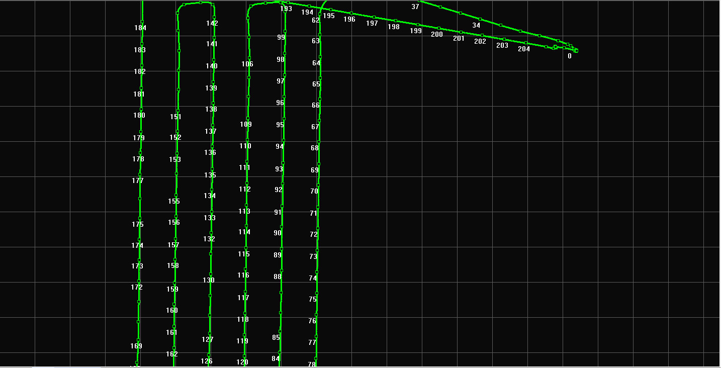
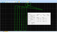
Trajectory Process
Positioning Altitude Aerial Photogrammetry Trajectory Process Software - YouTube
![]()
Select the Satellites and GNSS Date Decode (the .kqs file to .20o file)
![]()
![]()
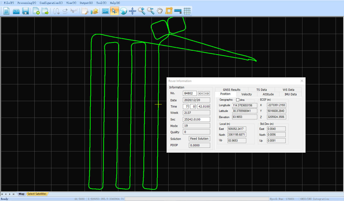
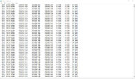
The GNSS results from Shuttle (kinematic Differencial GNSS)
![]()
![]()
![]()
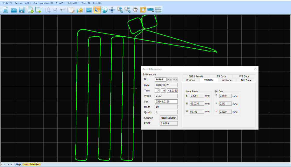
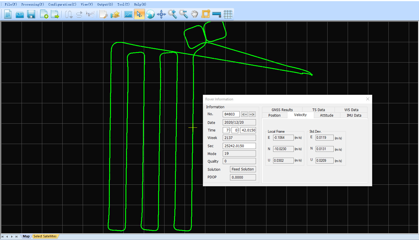
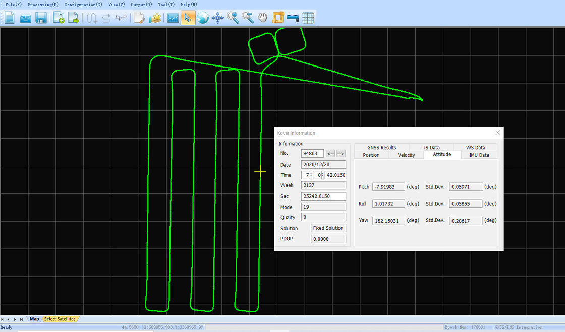
The GNSS/INS Integration results from Shuttle
![]()
![]()
Satellites View
![]()
Camera Trigger Event
![]()
INS Result
![]()
The links of 6.1 version of Shuttle software as following
https://drive.google.com/drive/folders/1S796Gns3sT96dUYv9XrzTcPTSULjAsF1?usp=sharing
Enter Your Message
| Wuhan Geosun Navigation Technology Co., Ltd |
| 4F, Building D, Tianyi plaza No.8 West Maodianshan Road, East Lake Hi-tech Zone Wuhan City, China |
| +86--15527360208 |
| sales@geosunlidar.com |