


EU Airborne UAV LiDAR Scanning GS-130X Hesai XT32 Laser Senor High Accuracy Pos Colored Point Cloud

Contact Person : Lanbooxie
Phone Number : +86 15527360208
WhatsApp : +8615527360208


| Minimum Order Quantity : | 1 | Price : | Negotiation |
|---|---|---|---|
| Packaging Details : | Suit Case 450*365*200 mm | Delivery Time : | 7-10 working days |
| Payment Terms : | T/T, Western Union | Supply Ability : | 30 sets/month |
| Place of Origin: | China | Brand Name: | Geosun |
|---|---|---|---|
| Certification: | CE, ISO | Model Number: | GS-100C+Drone LiDAR Scanning System |
|
Detail Information |
|||
| Platform: | DJI Matrice 300/DJI Matrice 600/Yuneec H850/GDU | Operation Efficiency: | 1.92 Km2 / Single Flight |
|---|---|---|---|
| High Density: | 720000 Points/s | Light Weight: | 1022g |
| Material: | Aluminum Alloy Body | Application: | Smart City Construction |
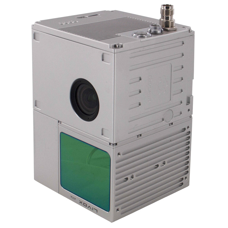
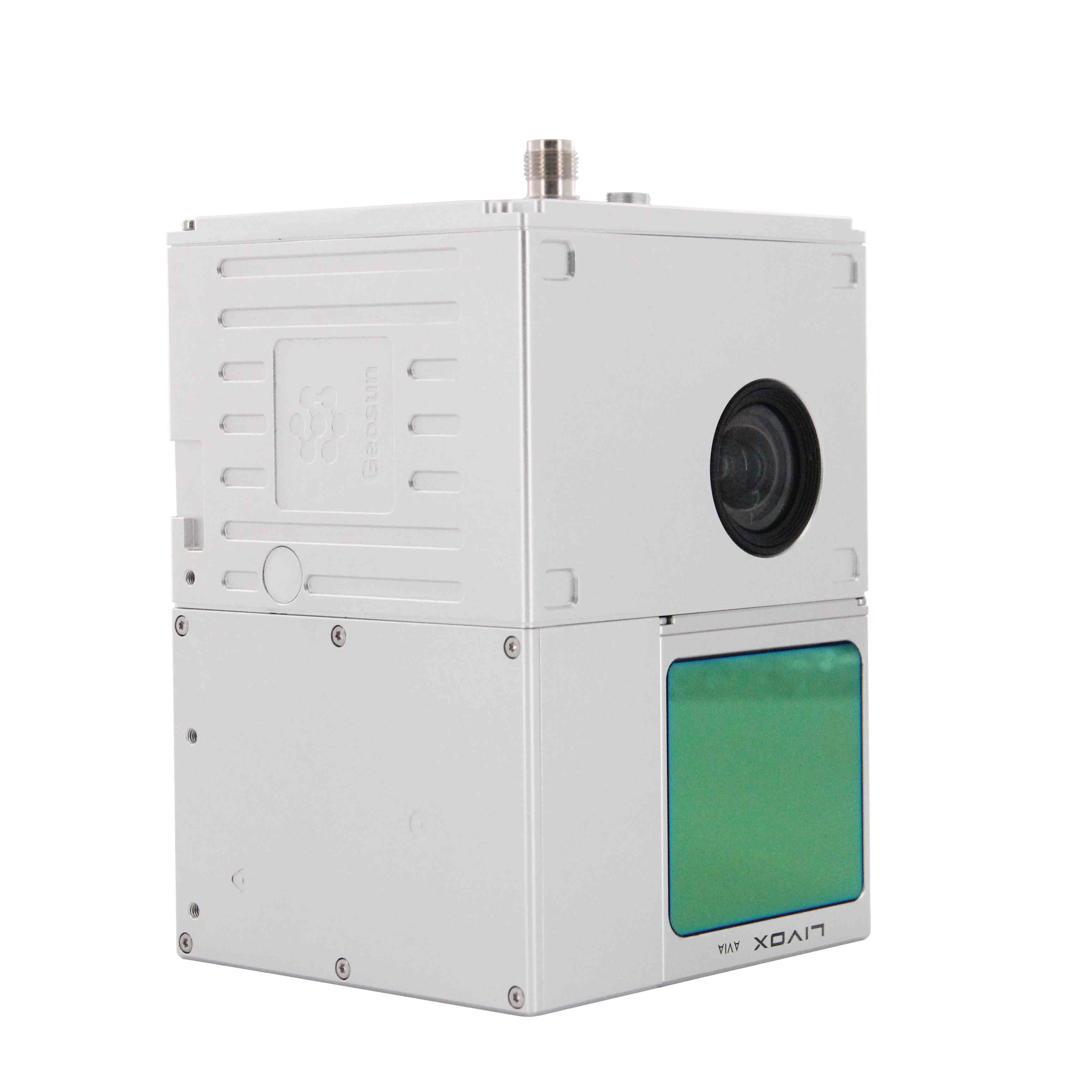
| Laser Sensor: | Livox Avia | Working Temperature: | -20°~+55° |
| Built-in Camera: | 26MP | Trajectory Software: | Shuttle |
| OEM Service: | Support | ||
| High Light: | GS-100C+ UAV LiDAR System,UAV LiDAR System DJI Matrice 300,Aerieal Mapping Uav Drone Survey |
||
Product Description
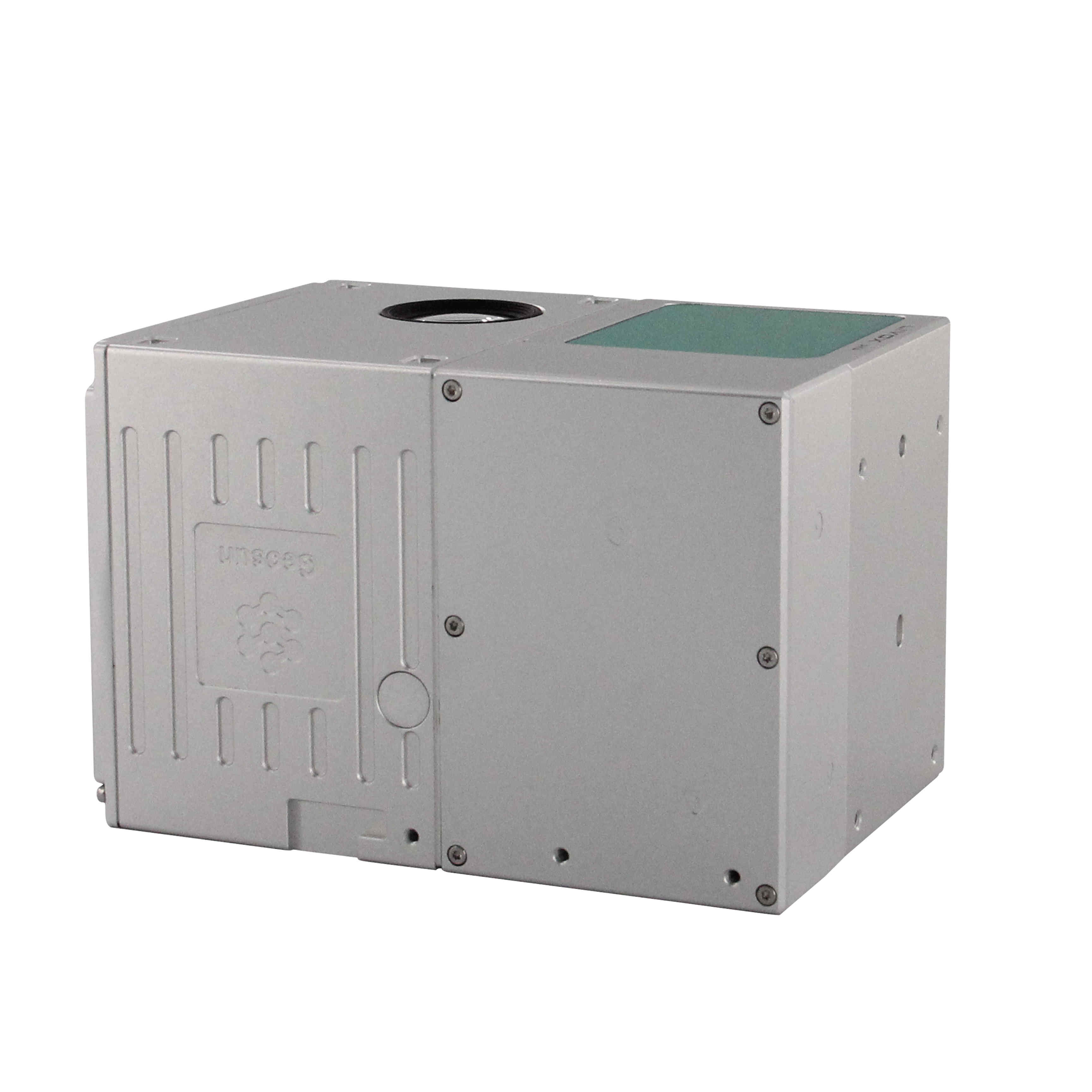
Geosun Drone LiDAR GS-100C+ Support DJI Matrice 300 Yuneec H850 Aerial Mapping
Geosun gAirHawk Series GS-100C+ Drone LiDAR
Geosun gAirHawk Series GS-100C+ Drone LiDAR Specification
|
Drone LiDAR Scanning System gAirHawk GS-100C+ |
||
|
|
Item Name |
System Parameter |
|
Parameter |
Weight |
1022g |
|
Measuring accuracy |
Less than 10 cm (110 m AGL) |
|
|
Power range |
12V~16V |
|
|
Working temperature |
-20℃~+55℃ |
|
|
Consumption |
Average 20W |
|
|
Support Platform |
GS-800 Multi Rotor, VTOL Fixed Wing |
|
|
Storage |
64 GB storage, maximum support 128GB TF card |
|
|
Lidar Unit
|
Laser Model |
Livox Avia |
|
Measuring Range |
190m@10% Reflectivity |
|
|
Laser class |
905nm Class1 (IEC 60825-1:2014) |
|
|
Laser line number |
Equivalent to 64-beam |
|
|
Range Precision |
2cm |
|
|
data |
Triple-echo, 720,000 Points/Sec |
|
|
FOV |
70° the circular view |
|
|
POS Unit |
Update frequency |
200HZ |
|
Heading accuracy |
0.040° |
|
|
Pitch accuracy |
0.015° |
|
|
Rolling accuracy |
0.015° |
|
|
Position accuracy |
0.02 - 0.05m |
|
|
GNSS signal type |
GPSL1/L2/L5 GLONASSL1/L2 BDS B1/B2/B3 GAL E1/E5a/5b |
|
|
Pre-processing software |
POS software |
Output information: position, speed, attitude |
|
Point cloud software |
Output point cloud data format: LAS format, custom TXT format |
|
|
Built-in Camera |
FOV |
83 Degree |
|
Effective Pixel |
26 Mega Pixel |
|
|
Trigger event |
Distance or Time trigger |
|
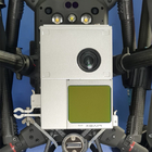
Geosun gAirHawk Series GS-100C+ Drone LiDAR Application
Geosun Malaysia partner have a demonstration for drone LiDAR scanning system GS-100C+mounted on drone DJI M300.
![]()
![]()
![]()
Geosun gAirHawk Series GS-100C+ Drone LiDAR Free Trial Software
The Guideline of LiDAR Usage and Reference.pdf
Point Cloud Pre-Processing Software Integrated With Trajectory Processing----Geosun Self-developed gAirHawk 5.0
Key Features of gAirHawk 5.0 Software
1. Raw data: intelligently load
2. Four default coordinates
3. Point cloud Optimization
4. Start and stop calculation
Free trial test, achieve high precision
![]()
![]()
Package of Drone LiDAR Scanning System GS-100C+
Drone LiDAR Scanning System GS-100C+ is packed by suit case with EVA material liner inside, then covered by hard carton box. It is suitable for air shipment and sea shipment.
![]()
![]()
Enter Your Message
| Wuhan Geosun Navigation Technology Co., Ltd |
| 4F, Building D, Tianyi plaza No.8 West Maodianshan Road, East Lake Hi-tech Zone Wuhan City, China |
| +86--15527360208 |
| sales@geosunlidar.com |