


EU Airborne UAV LiDAR Scanning GS-130X Hesai XT32 Laser Senor High Accuracy Pos Colored Point Cloud

Contact Person : Lanbooxie
Phone Number : +86 15527360208
WhatsApp : +8615527360208


| Minimum Order Quantity : | 1 | Price : | Negotiation |
|---|---|---|---|
| Packaging Details : | Suit Case 450*365*200 mm | Delivery Time : | 10-15 works days |
| Payment Terms : | T/T, Western Union | Supply Ability : | 30 SETS/Month |
| Place of Origin: | China | Brand Name: | Geosun |
|---|---|---|---|
| Certification: | CE, ISO | Model Number: | GS-260X LiDAR Scanning System |
|
Detail Information |
|||
| Operation Efficiency: | 2.5 Km2 / Single Flight | Application: | Mapping & Survey |
|---|---|---|---|
| Channel: | 32 Channel | Laser Brand: | HESAI Pandar XTM2X |
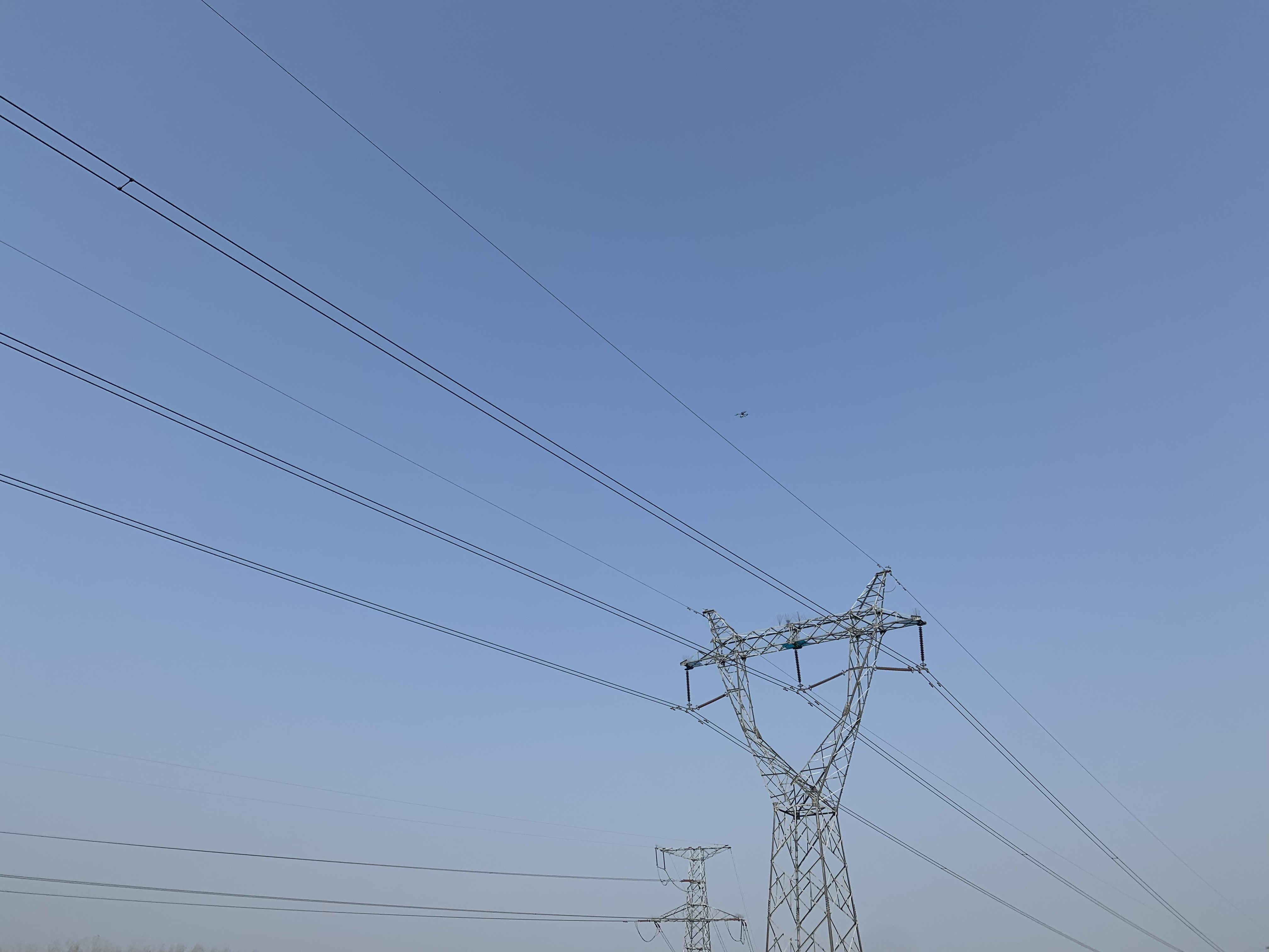
| Material: | Aluminum Alloy Body | Appication: | Power Line |
| High Light: | GS-260X LiDAR Scanning System,LiDAR Scanning System 3D Surveying,DJI M600 Lidar Drone Scanner |
||
Product Description
Power Line Inspection Aerial Mapping UAV LiDAR Drone Mapping Colored Point Cloud High Accuracy
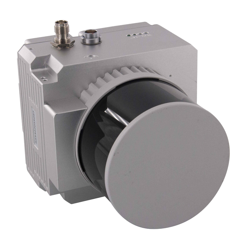
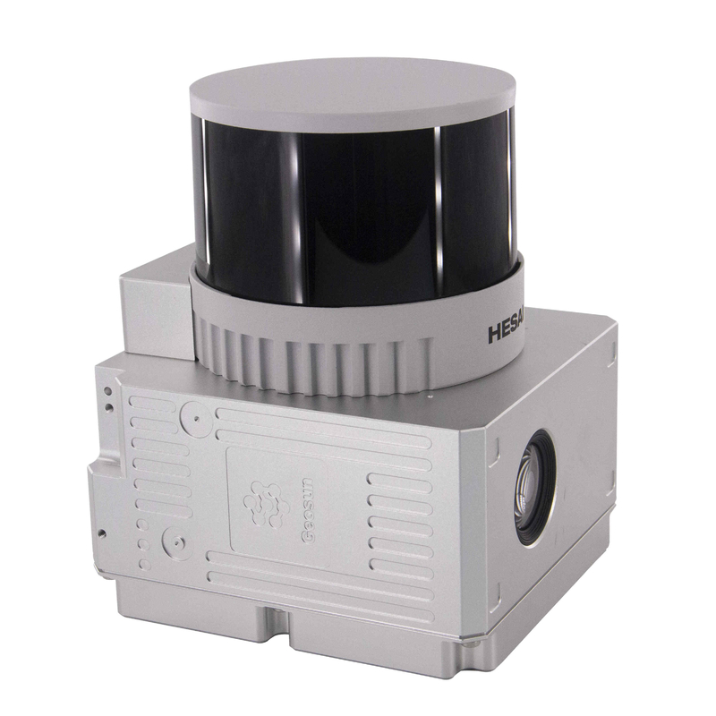
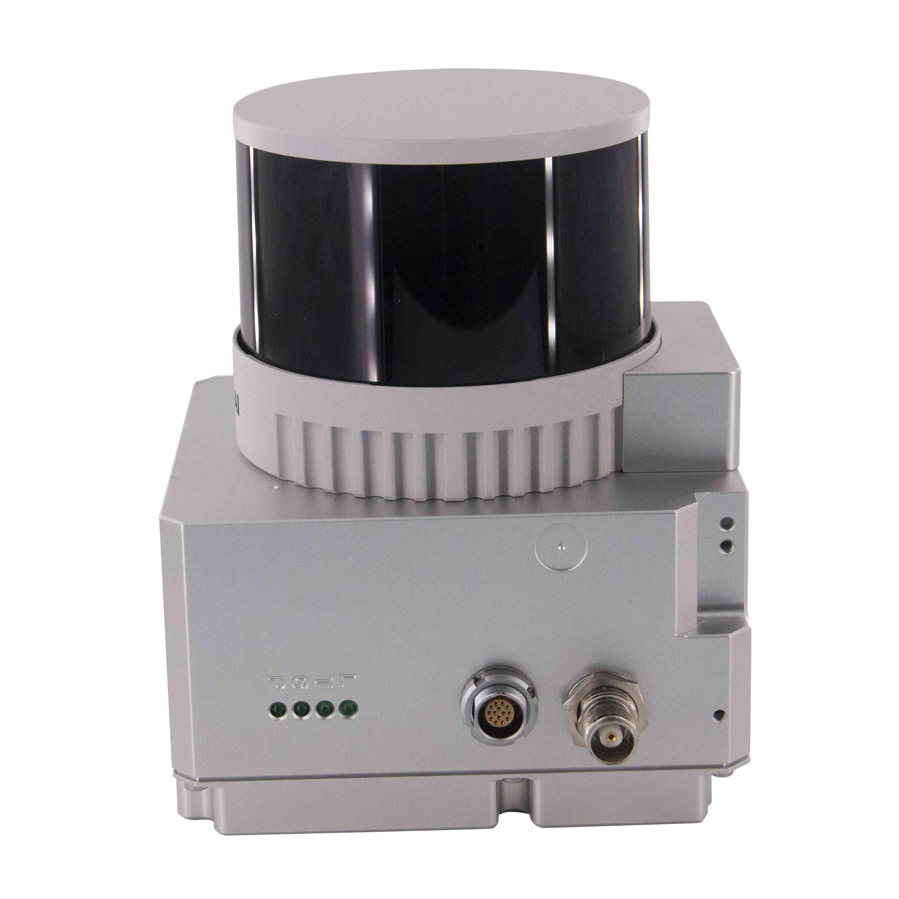
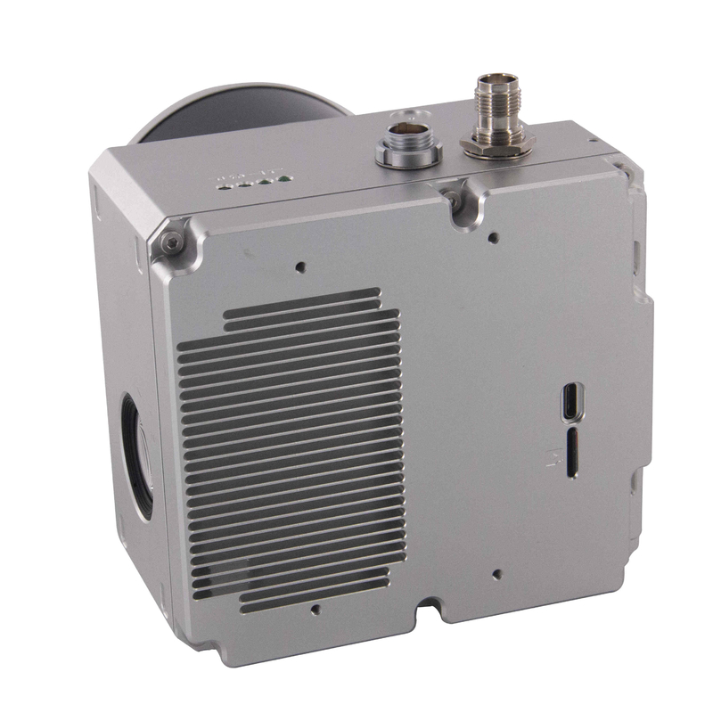
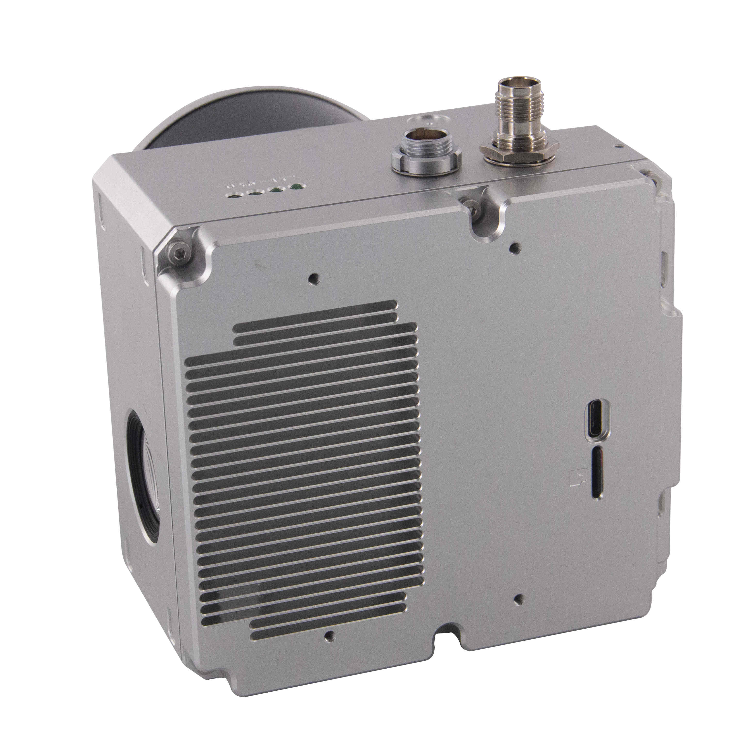
Geosun gAirHawk Series GS-260X UAV LiDAR Scanning System
gAirHawk GS-260X is a kind of Mid-range, compact LiDAR point cloud data acquisition system, integrated HESAI Pandar XT laser scanner, GNSS and IMU positioning and attitude determination system, and storage control unit, is able to real-time, dynamically, massively collect high-precision point cloud data and rich image information. It is widely used in the acquisition of 3D spatial information in surveying, electricity, forestry, agriculture, land planning.
Specification of UAV LiDAR Scanning System GS-260X
| UAV LiDAR Scanning System gAirHawk GS-260X | ||
| Item Name | System Parameters | |
|
GS-260X Parameters |
Weight | 1.15 kg |
| Measuring accuracy | Less than 0.1m/0.05m(@150m) | |
| Working temperature | -20℃~+65℃ | |
| Power range | 12 V- 24 V | |
| Consumption | 10 W | |
| Carrying Platform | DJI M300, M600 PRO and Other brand | |
| Storage | 64 GB storage, maximum support 128GB TF card | |
|
Lidar Unit
|
Measuring Range | 80m@10% Reflectivity (Max 300m) |
| Laser class | 905nm Class1 (IEC 60825-1:2014) | |
| Channel | 32-Channel | |
| Range accuracy | ±1cm (typical Value) | |
| Scanning frequency | 10HZ, 20HZ | |
| data | Trible echo 1,920,000 Points/Sec | |
| FOV | 360°, adjustable | |
| Laser sensor | HESAI Pandar XTM2X | |
| POS Unit | Update frequency | 200HZ |
| Heading accuracy | 0.017° | |
| Pitch accuracy | 0.005° | |
| Rolling accuracy | 0.005° | |
| Position accuracy | ≤0.05m | |
| GNSS signal type | GPSL1/L2/L5 GLONASSL1/L2 BDS B1/B2/B3 GAL E1/E5a/5b | |
| Pre-processing software | POS software | Output information: position, speed, attitude |
| Point cloud software | Output point cloud data format: LAS format, custom TXT format | |
|
Camera (built-in) |
FOV | 83 Degree |
| Effective Pixel | 26 Mega Pixel | |
| Trigger event | Distance or Time trigger | |
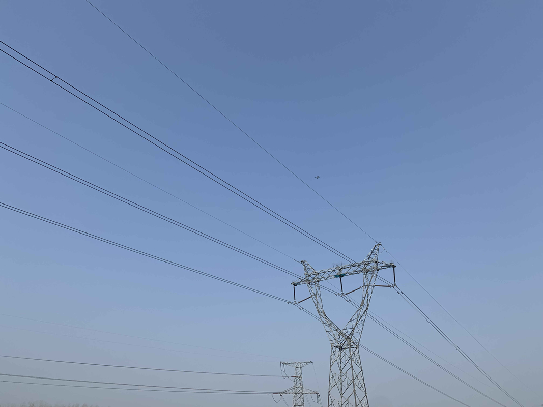
Power Line Application of UAV LiDAR Scanning System GS-260X
![]()
![]()
![]()
![]()
![]()
![]()
Package of UAV LiDAR Scanning System GS-260X
UAV LiDAR scanning system GS-260X is packed by suit case with EVA material liner inside, then covered by hard carton box. It is suitable for air shipment and sea shipment.
![]()
![]()
Enter Your Message
| Wuhan Geosun Navigation Technology Co., Ltd |
| 4F, Building D, Tianyi plaza No.8 West Maodianshan Road, East Lake Hi-tech Zone Wuhan City, China |
| +86--15527360208 |
| sales@geosunlidar.com |