


EU Airborne UAV LiDAR Scanning GS-130X Hesai XT32 Laser Senor High Accuracy Pos Colored Point Cloud

Contact Person : Lanbooxie
Phone Number : +86 15527360208
WhatsApp : +8615527360208

| Minimum Order Quantity : | 1 | Price : | Negotiation |
|---|---|---|---|
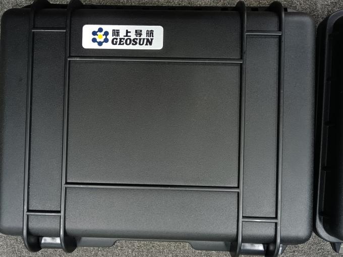
| Packaging Details : | Suit case 450*365*200 mm | Delivery Time : | 10-15 works days |
| Supply Ability : | 30 sets/month |
| Place of Origin: | China | Brand Name: | Geosun |
|---|---|---|---|
| Certification: | CE,ISO | Model Number: | GS-260F Drone LiDAR Scanning System |
|
Detail Information |
|||
| Material: | Aluminum Alloy Body | Channel: | 40-channel |
|---|---|---|---|
| Application: | Forestry, Power Line Patrol, Historical Relics | Weight: | 2.1kg |
| Dimension: | 18.6*10.9*12cm | Working Temperature: | -20°~+55° |
| Accuracy: | 10cm@150m | Carring Platform: | Multi-Rotor/Vehicle |
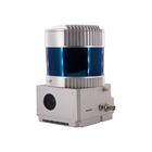
| High Light: | RTK Model Uav Lidar Scanner,GS-260F Uav Lidar Scanner,HESAI Pandar 40P uav scanner |
||
Product Description
GS-260F RTK Model Drone LiDAR Scanner HESAI Pandar40P Multi Platform Free Trajectory Processing
Geosun gAirHawk Series Drone LiDAR Scanning System GS-260F
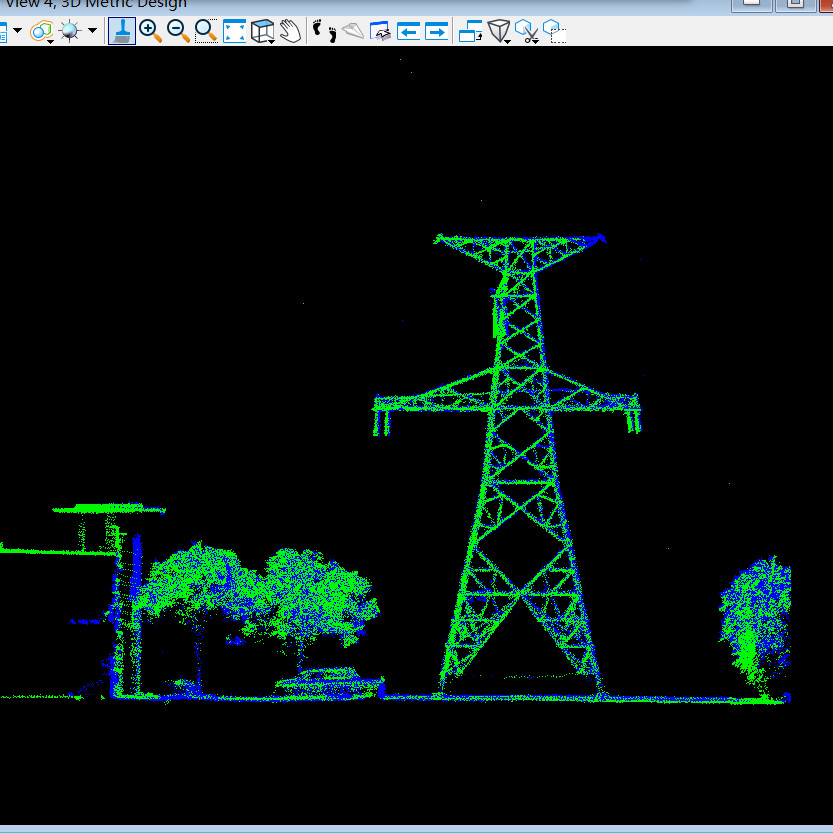
GS-260F drone LiDAR scanning system is an UAV measurement system independently developed by Geosun company. It highly integrates laser scanner, GNSS satellite positioning system, INS inertial navigation system and camera(built-in), and can quickly obtain high-precision laser point cloud number. It can be widely used in Power line,Digital city construction, Industry, Land survey, Forestry and Agriculture.
Drone LiDAR Scanning System GS-260F Application to Power line Inspection (rTK Model)
![]()
![]()
![]()
Free Trial Software Drone LiDAR Scanning System gAirHawk GS-260F
Free trial test, achieve high precision
The Guideline of LiDAR Usage and Reference.pdf
Point Cloud Pre-Processing Software Integrated With Trajectory Processing----Geosun Self-developed gAirHawk 5.0
Key Features of gAirHawk 5.0 Software
1. Raw data: intelligently load
2. Four default coordinates
3. Point cloud Optimization
4. Start and stop calculation
![]()
![]()
Drone LiDAR Scanning System gAirHawk GS-260F Specification
|
|||||||||||||||||||||||||||||||||||||||||||||||||||||||||||||||||
Drone LiDAR Scanning System gAirHawk GS-260F Package
Drone LiDAR Scanning System gAirHawk GS-260F is packed by suit case with EVA material liner inside, then covered by hard carton box.It is suitable for air shipment and sea shipment.
![]()
Enter Your Message
| Wuhan Geosun Navigation Technology Co., Ltd |
| 4F, Building D, Tianyi plaza No.8 West Maodianshan Road, East Lake Hi-tech Zone Wuhan City, China |
| +86--15527360208 |
| sales@geosunlidar.com |