


EU Airborne UAV LiDAR Scanning GS-130X Hesai XT32 Laser Senor High Accuracy Pos Colored Point Cloud

Contact Person : Lanbooxie
Phone Number : +86 15527360208
WhatsApp : +8615527360208

| Minimum Order Quantity : | 1 | Price : | Negotiation |
|---|---|---|---|
| Packaging Details : | Suit Case 530*430*240 mm | Delivery Time : | 10-15 works days |
| Payment Terms : | T/T, Western Union | Supply Ability : | 30 SETS/Month |
| Place of Origin: | China | Brand Name: | Geosun |
|---|---|---|---|
| Certification: | CE, ISO | Model Number: | GS-260X LiDAR Scanning System |
|
Detail Information |
|||
| Operation Efficiency: | 2.5 Km2 / Single Flight | Application: | Mapping & Survey |
|---|---|---|---|
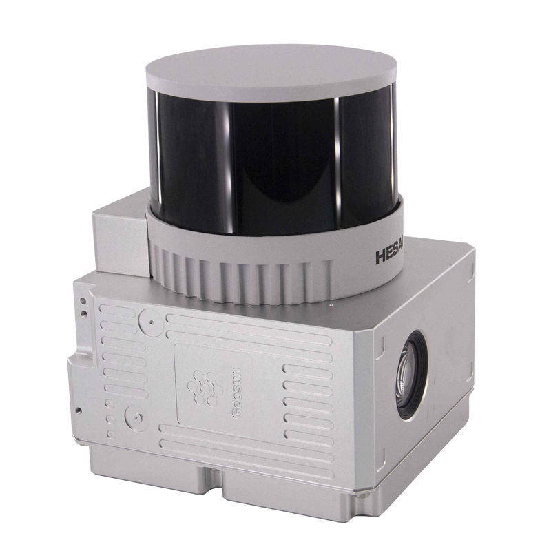
| Channel: | 32 Channel | Laser Brand: | HESAI Pandar XTM2X |
| High Light: | DJI M600 Pro LiDAR Scanning System,HESAI Pandar LiDAR Scanning System,DJI M600 Pro lidar scanner |
||
Product Description
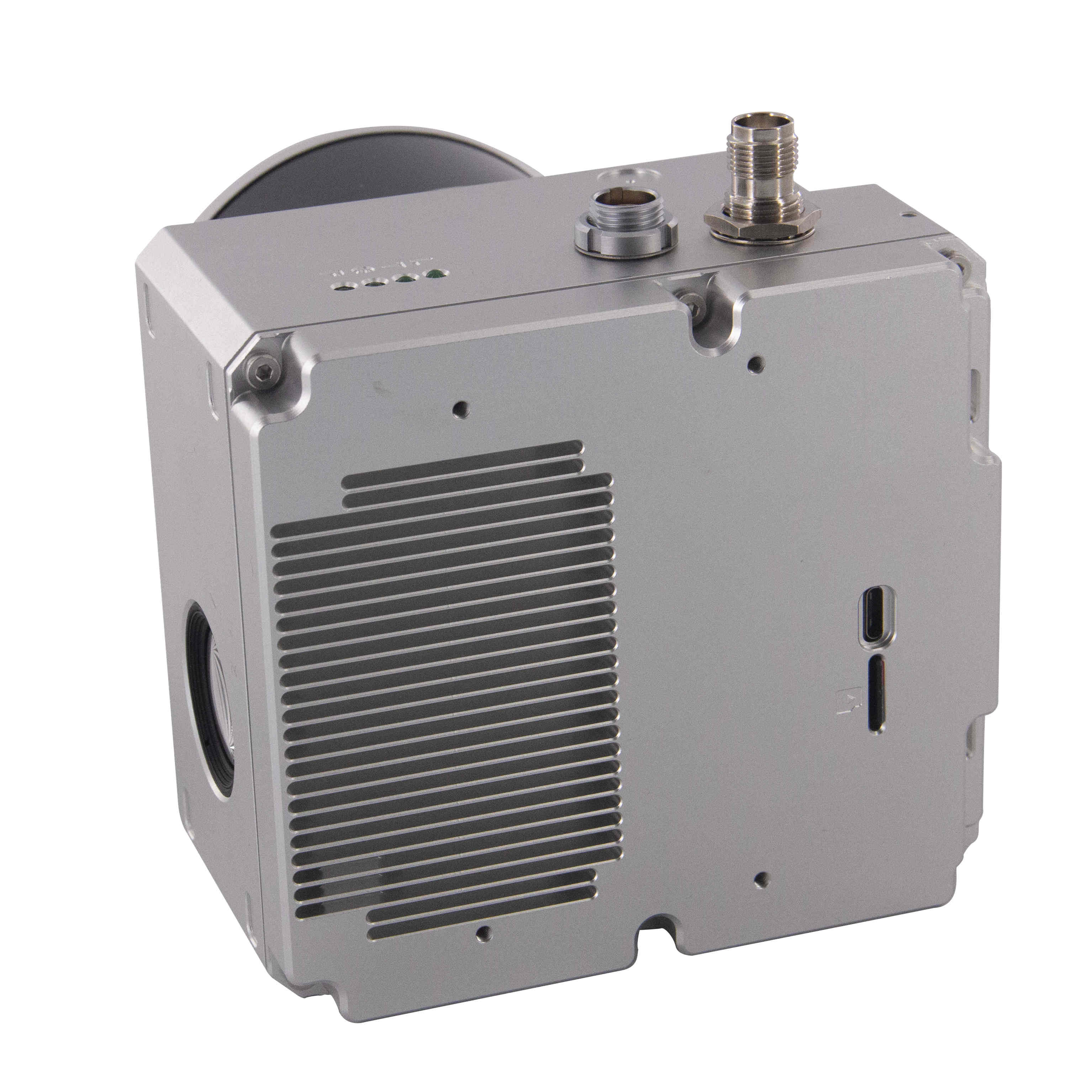
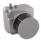
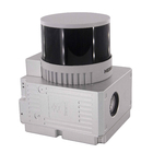
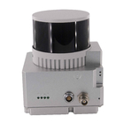
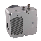
DJI M600 Pro 32 Channel HESAI Pandar Laser UAV LiDAR Scanning System GS-260X Forestry
Geosun gAirHawk Series GS-260X uav LiDAR Scanning System
gAirHawk GS-260X is a kind of Mid-range, compact LiDAR point cloud data acquisition system, integrated HESAI Pandar XT laser scanner, GNSS and IMU positioning and attitude determination system, and storage control unit, is able to real-time, dynamically, massively collect high-precision point cloud data and rich image information. It is widely used in the acquisition of 3D spatial information in surveying, electricity, forestry, agriculture, land planning.
Specification of uav LiDAR Scanning System GS-260X
|
|||||||||||||||||||||||||||||||||||||||||||||||||||||||||||||||||
Application of uav LiDAR Scanning System GS-260X
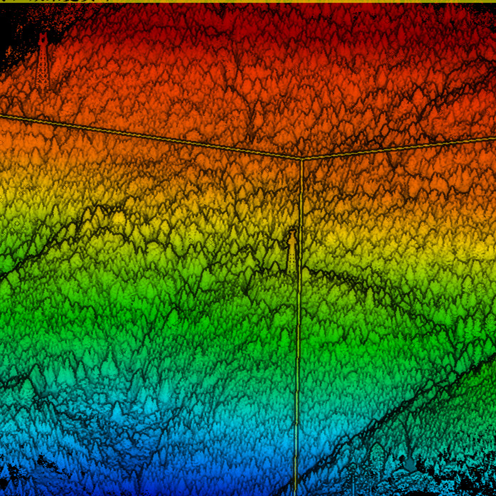
uav LiDAR GS-260X is used to capture mountain forestry information.
Terrain difference is 400m.
Terrain follow height is 80m.
Flight speed 5m/s.
![]()
![]()
![]()
![]()
Package of uav LiDAR Scanning System GS-260X
uav LiDAR Scanning System GS-260X is packed by suit case with EVA material liner inside, then covered by hard carton box. It is suitable for air shipment and sea shipment.
![]()
![]()
Enter Your Message
| Wuhan Geosun Navigation Technology Co., Ltd |
| 4F, Building D, Tianyi plaza No.8 West Maodianshan Road, East Lake Hi-tech Zone Wuhan City, China |
| +86--15527360208 |
| sales@geosunlidar.com |