


Point Cloud Automata (PCA) Post-processing software

Contact Person : Lanbooxie
Phone Number : +86 15527360208
WhatsApp : +8615527360208

| Minimum Order Quantity : | 1 | Price : | Negotiation |
|---|---|---|---|
| Packaging Details : | None | Delivery Time : | 1-3 Working Days Since Payment |
| Payment Terms : | T/T, Western Union | Supply Ability : | No limitation |
| Place of Origin: | China | Brand Name: | Geosun |
|---|---|---|---|
| Certification: | Intellectual Property Right | Model Number: | gAirhawk Software |
|
Detail Information |
|||
| Name: | GAirhawk LiDAR Data Process Software | Application 1: | Point Clouds Output |
|---|---|---|---|
| Application 2: | LAS File Output | Function 3: | 3D Data Processing |
| High Light: | LAS File Generated Software,Point Cloud LiDAR Data Processing Software,LiDAR 3D Data Processing |
||
Product Description
gAirHawk Software Introduction
Point Cloud Data Process and LAS File Generated Software
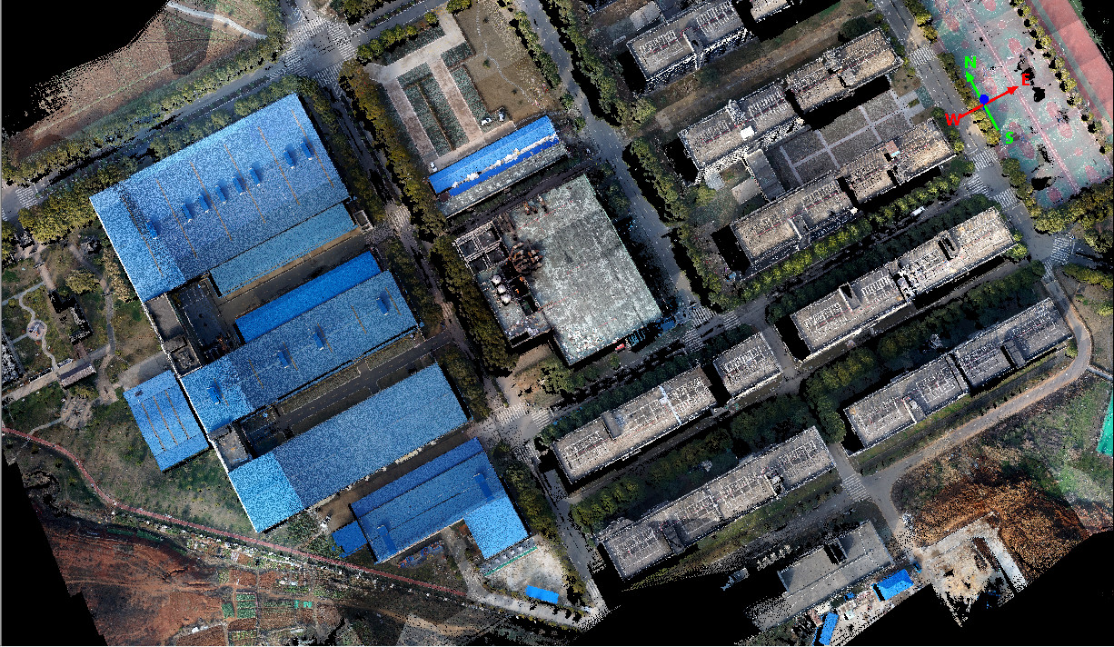
gAirHawk is a lidar scanning system acquisition monitoring and point cloud computing software self-developed by Geosun Navigation. It supports real-time configuration and monitoring of field data acquisition systems, decoding of real-time and post-process laser scanning data, calculation and display of point cloud data, supporting software for Geosun lidar scanning system.
The Interface of gAirhawk
The Operation of 4 8 Version of gAirhawk Software - YouTube
![]()
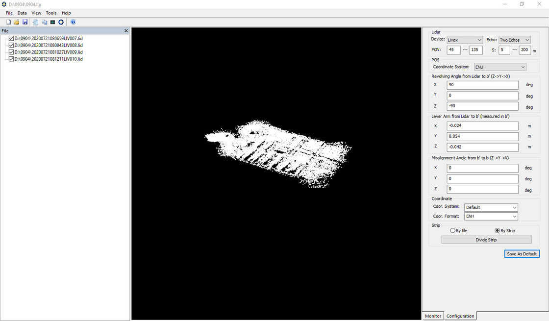
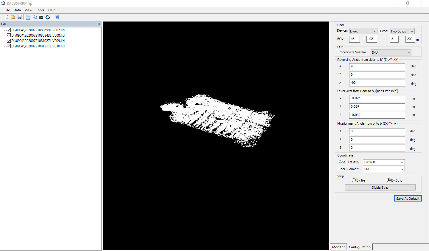
Creat New Project and Operation
![]()
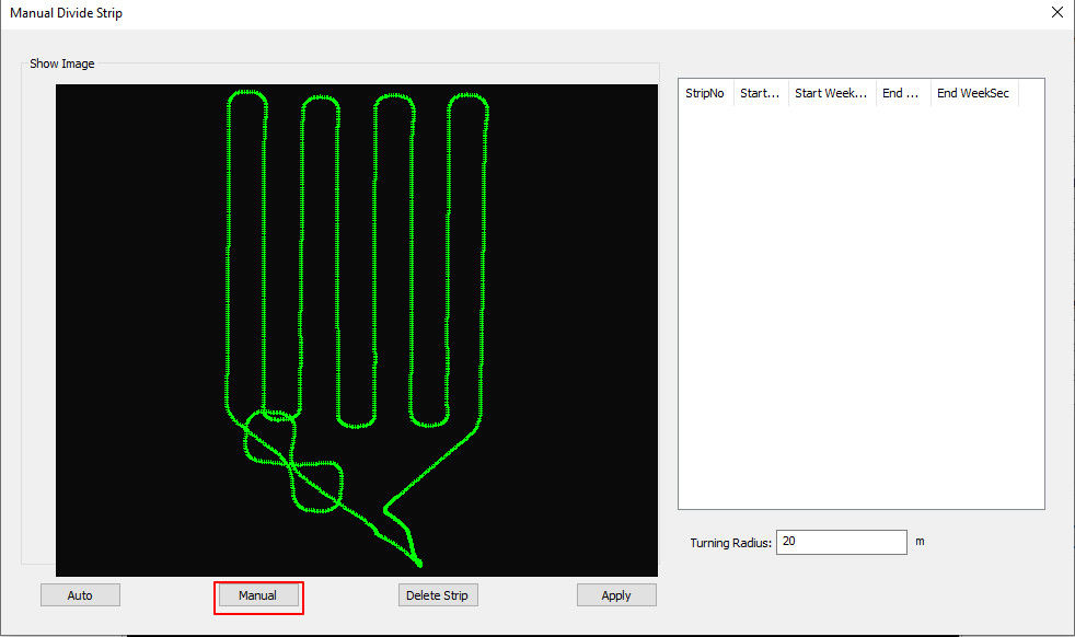
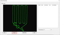
Divided by Strip
![]()
![]()
![]()
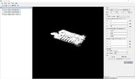
Lidar data process and point clouds output
![]()
![]()
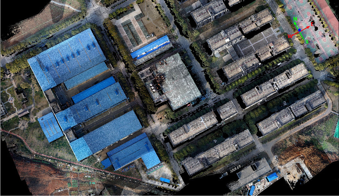
Color point clouds
![]()
![]()
The links of 4.6 version of gAirhawk software as following
https://drive.google.com/drive/folders/14PqJiu5K7_wKgyA6y4AZBZbdVBYZNd6O?usp=sharing
Enter Your Message
| Wuhan Geosun Navigation Technology Co., Ltd |
| 4F, Building D, Tianyi plaza No.8 West Maodianshan Road, East Lake Hi-tech Zone Wuhan City, China |
| +86--15527360208 |
| sales@geosunlidar.com |