


EU Airborne UAV LiDAR Scanning GS-130X Hesai XT32 Laser Senor High Accuracy Pos Colored Point Cloud

Contact Person : Lanbooxie
Phone Number : +86 15527360208
WhatsApp : +8615527360208


| Minimum Order Quantity : | 1 | Price : | Negotiation |
|---|---|---|---|
| Packaging Details : | Suit Case 450*365*200 mm | Delivery Time : | 10-15 works days |
| Payment Terms : | T/T, Western Union | Supply Ability : | 30 SETS/Month |
| Place of Origin: | China | Brand Name: | Geosun |
|---|---|---|---|
| Certification: | CE, ISO | Model Number: | GS-260F LiDAR Scanning System |
|
Detail Information |
|||
| Operation Efficiency: | 4.5 Km2 / Single Flight | Application: | Mapping & Survey |
|---|---|---|---|
| Beam: | 40 Beam | Laser Brand: | HESAI Pandar 40P |
| High Light: | DJI M600 Pro LiDAR Scanning System,40 Beam airborne lidar system,GS 260F LiDAR Scanning System |
||
Product Description
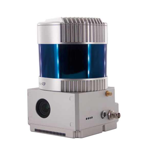
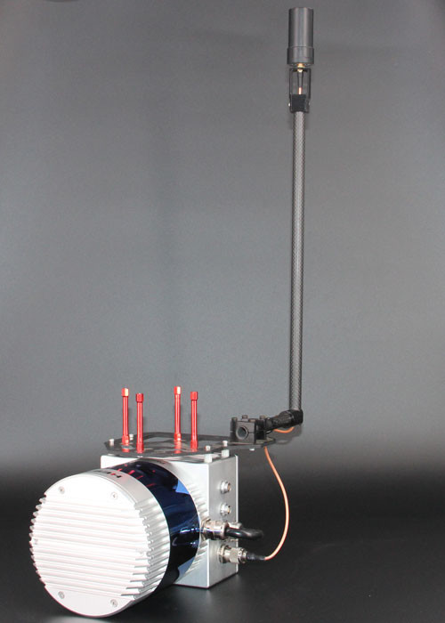
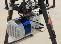
Drone Surveying HESAI Pandar40p Laser Scanner Geosun GS-260F UAV LiDAR Scanning System
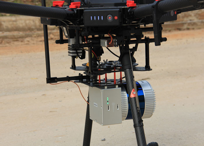
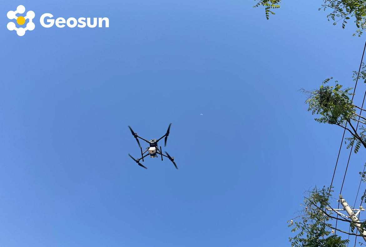
LiDAR Scanning System with HESAI Pandar Laser Sensor Mounted on DJI M600 Pro
gAirHawk GS-260F is a kind of Mid-range, compact LiDAR point cloud data acquisition system, integrated HESAI Pandar 40P laser scanner, GNSS and IMU positioning and attitude determination system, and storage control unit, is able to real-time, dynamically, massively collect high-precision point cloud data and rich image information. It is widely used in the acquisition of 3D spatial information in surveying, electricity, forestry, agriculture, land planning.
Pandar40P 40-Channel Mechanical LiDAR
![]()
![]()
Geosun GS-260F UAV LiDAR Scanning System Specification
| gAirHawk GS-260F | ||
| Item Name | System Parameters | |
|
Parameters |
Weight | 2.1kg |
| Measuring accuracy | 0.1m/0.05m(@150m) | |
| Working temperature | -20℃~+60℃ | |
| Power range | 12V- 24V | |
| Consumption | 20W | |
| Carrying Platform | DJI M300, M600 PRO | |
| Storage | 64 GB storage, maximum support 128GB TF card | |
|
Lidar Unit
|
Measuring Range | 0.3m-200m@20% Reflectivity |
| Laser class | 905nm Class1 (IEC 60825-1:2014) | |
| Laser line number | 40-Beam | |
| Max. range | 200m | |
| Mix. range | 0.3m | |
| Range accuracy | ±5cm (@0.3m~5m), ±2cm (@0.5m~200m) | |
| Scanning frequency | 10HZ, 20HZ | |
| data | Double-echo 720,000 Points/Sec | |
| FOV | 360°, adjustable | |
| Laser sensor | HESAI Pandar40P | |
| POS Unit | Update frequency | 200HZ |
| Heading accuracy | 0.017° | |
| Pitch accuracy | 0.005° | |
| Rolling accuracy | 0.005° | |
| Position accuracy | ≤0.05m | |
| GNSS signal type | GPSL1/L2/L5 GLONASSL1/L2 BDS B1/B2/B3 GAL E1/E5a/5b | |
| Pre-processing software | POS software | Output information: position, speed, attitude |
| Point cloud software | Output point cloud data format: LAS format, custom TXT format | |
| Camera | FOV | 83 Degree |
| Effective Pixel | 26 Mega Pixel Resolution | |
| Trigger event | Distance or Time trigger | |
Geosun GS-260F UAV LiDAR Scanning System Application for Mine Capacity Measurement
![]()
Free Trial Software UAV LiDAR Scanning System gAirHawk GS-260F
Free trial test, achieve high precision
The Guideline of LiDAR Usage and Reference.pdf
Point Cloud Pre-Processing Software Integrated With Trajectory Processing----Geosun Self-developed gAirHawk 5.0
Key Features of gAirHawk 5.0 Software
1. Raw data: intelligently load
2. Four default coordinates
3. Point cloud Optimization
4. Start and stop calculation
![]()
![]()
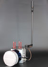
Geosun GS-260F UAV LiDAR Scanning System Package
Geosun GS-260F UAV LiDAR Scanning System is packed by suit case with EVA material liner inside, then covered by hard carton box. It is suitable for air shipment and sea shipment.
![]()
![]()
Enter Your Message
| Wuhan Geosun Navigation Technology Co., Ltd |
| 4F, Building D, Tianyi plaza No.8 West Maodianshan Road, East Lake Hi-tech Zone Wuhan City, China |
| +86--15527360208 |
| sales@geosunlidar.com |