
|
Product Details:
|
|
| Place of Origin: | China |
|---|---|
| Brand Name: | Geosun |
| Certification: | CE, ISO |
| Model Number: | GS-2000N UAV LiDAR Scanning System |
|
Payment & Shipping Terms:
|
|
| Minimum Order Quantity: | 1 |
| Price: | Negotiation |
| Packaging Details: | Suit case 450*365*200 mm |
| Delivery Time: | 10 works days |
| Payment Terms: | T/T, Western Union |
| Supply Ability: | 30 sets/month |
|
Detail Information |
|||
| Name: | UAV LiDAR Scanning System | Operation Efficency: | 2.8 K㎡ Per Single Flight |
|---|---|---|---|
| Application: | Topography, Forestry, Powerline, Smart City | Channel: | Mapping & Survey |
| Material: | Aluminum Alloy Body | Accuracy: | ≤10cm@600m |
| Dimension: | 245*140.5*125mm | Weight: | 3.2kg |
| Storage: | 64GB Max Support 128GB TF Card | Working Temperature: | -20°~+55° |
| Carry Platform: | Multi-Rotor, VTOL | Trajectory Software: | Shuttle |
| Point Cloud Software: | GAirHawk | ||
| High Light: | UAV VTOL LiDAR Scanning,Terrain Mapping VTOL LiDAR Scanning,Long Range UAV LiDAR System |
||
Product Description
Terrain Mapping Long Range Detection LiDAR Scanning Support VTOL Airborne High Accuracy DEM
Geosun gAirHawk Series GS-2000N UAV LiDAR Scanning System
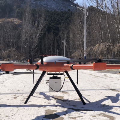
UAV LiDAR Scanning System gAirHawk GS-2000N is a kind of long range, compact LiDAR point cloud data acquisition system, integrated FT-1500H long range laser scanner, GNSS and IMU positioning and attitude determination system, and storage control unit, is able to real-time, dynamically, massively collect high-precision point cloud data and rich image information. It is widely used in the acquisition of 3D spatial information in surveying, electricity, forestry, agriculture, land planning.
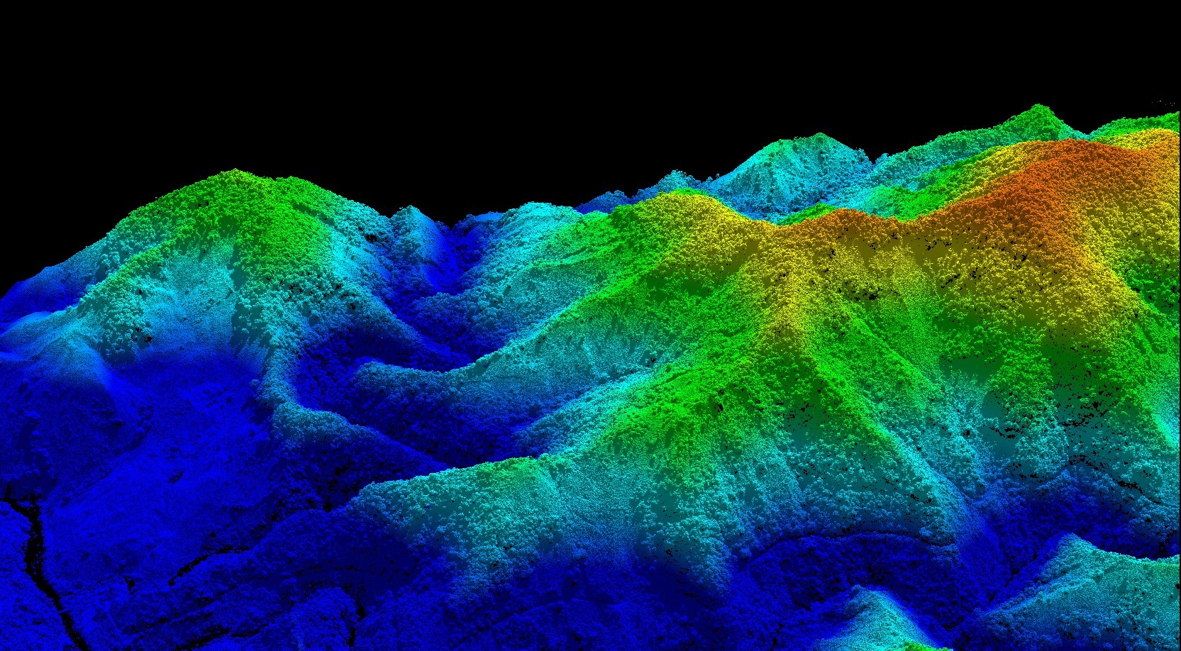
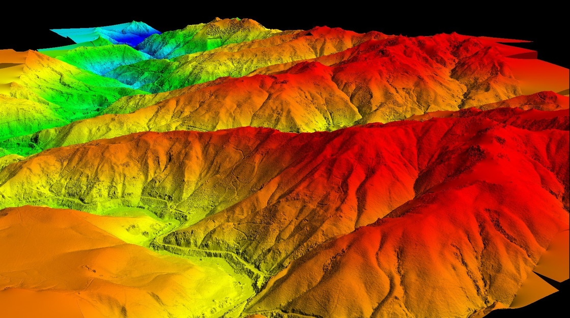
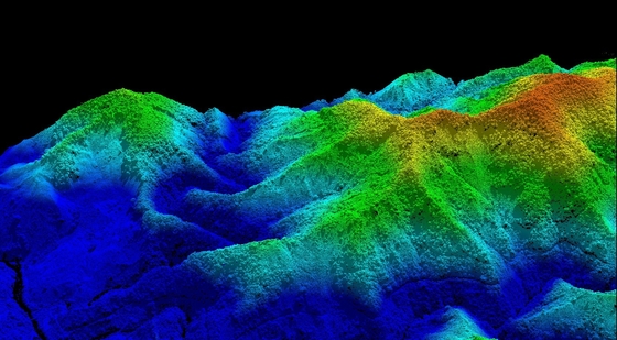
Application of UAV LiDAR Scanning System gAirHawk GS-2000N
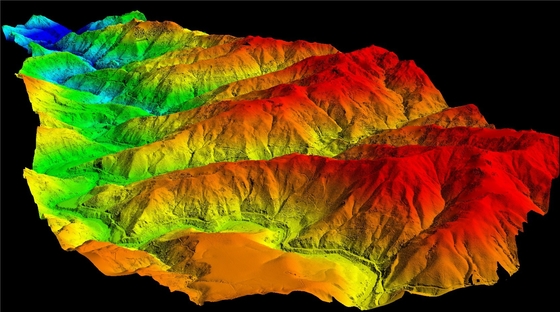
GS-2000N Columbia is being used in a manned aircraft project, with a terrain drop of 900 meters and a high flight speed of 35m/s. With its 2 million pulses per second high frequency, the 1350N is perfectly suited for airborne applications within the 75-90° field of view, with a point density four times that of a full-angle laser. Despite the high altitude and speed, the system still maintains a complete power line and excellent penetration performance.
![]()
![]()
![]()
![]()
Free Trial Software UAV LiDAR Scanning System gAirHawk GS-2000N
Free trial test, achieve high precision
The Guideline of LiDAR Usage and Reference.pdf
Point Cloud Pre-Processing Software Integrated With Trajectory Processing----Geosun Self-developed gAirHawk 5.0
Key Features of gAirHawk 5.0 Software
1. Raw data: intelligently load
2. Four default coordinates
3. Point cloud Optimization
4. Start and stop calculation
![]()
![]()
Specification of UAV LiDAR Scanning System gAirHawk GS-1350N
|
uav LiDAR scanning system gAirHawk GS-2000N |
||
|
|
Item Name |
System Parameters |
|
Parameters |
Weight |
3.2kg |
|
Working temperature |
-20℃~+60℃ |
|
|
Power range |
12V- 24V |
|
|
Consumption |
65W |
|
|
Carrying Platform |
6 Aixs Multi Rotor Drone |
|
|
Storage |
64 GB storage, maximum support 128GB TF card |
|
|
Laser Unit
|
Measuring Range |
2000m@80% |
|
Laser class |
1550 nm Class1 (IEC 60825-1:2014) |
|
|
Laser line number |
FT-1500H Single-Beam |
|
|
Measuring accuracy |
3mm@100m |
|
|
Max. range |
2000m |
|
|
Return |
7 echos |
|
|
Pulse frequency |
50 HZ-2000HZ |
|
|
Beam Divergence |
0.3mrad |
|
|
FOV |
75°-90°, adjustable |
|
|
POS Unit |
Update frequency |
200HZ |
|
Heading accuracy |
0.010° |
|
|
Pitch accuracy |
0.003° |
|
|
Rolling accuracy |
0.003° |
|
|
Position accuracy |
Horizontal: 0.02m, Vertical: 0.03m |
|
|
GNSS signal type |
GPSL1/L2/L5 GLONASSL1/L2 BDS B1/B2/B3 GAL E1/E5a/5b |
|
|
IMU |
gSpin 410 |
|
|
Pre-processing software |
POS software |
Output information: position, speed, attitude |
|
Point cloud software |
Output point cloud data format: LAS format, custom TXT format |
|
|
Camera (built-in) |
FOV |
48*33 Degree |
|
Effective Pixel |
45 MP (Full Frame Camera) |
|
|
focal Length(mm) |
16 |
|
Package of UAV LiDAR Scanning System gAirHawk GS-2000N
UAV LiDAR Scanning System GS-2000N is packed by suit case with EVA material liner inside, then covered by hard carton box.
The pacakge of uav LiDAR scanning system is suitable for air shipment and sea shipment.![]()
![]()
Enter Your Message
| Wuhan Geosun Navigation Technology Co., Ltd |
| 4F, Building D, Tianyi plaza No.8 West Maodianshan Road, East Lake Hi-tech Zone Wuhan City, China |
| +86--15527360208 |
| sales@geosunlidar.com |