
Contact Person : Lanbooxie
Phone Number : +86 15527360208
WhatsApp : +8615527360208
January 5, 2022
UAV LiDAR Scanning System GS-260X Application for Forestry
GS-260X+Camera uav LiDAR Scanning System are application for Forestry.
The Project Information
Hills and Foresty in Hunan Province
120m Flight Height
6m/s Speed
The penetration is very good, the density of point cloud are perfect.
The performance is as following,
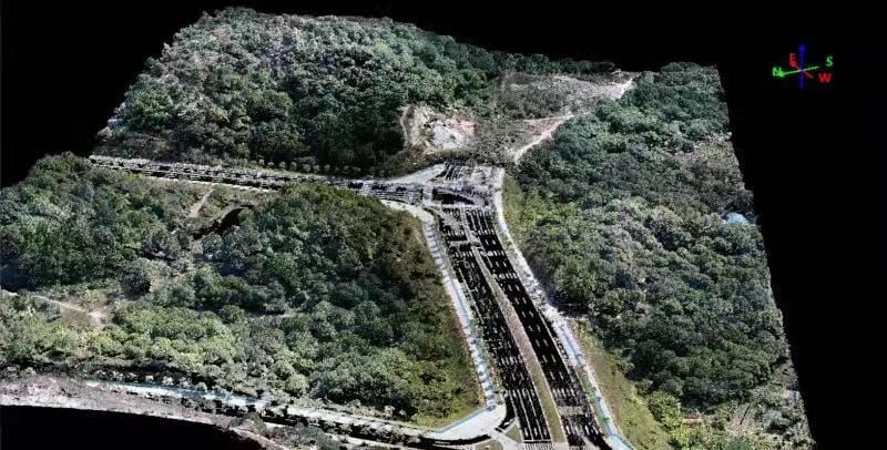
Full View of Flight Area
![]()
![]()
The density of point cloud is 269.927 per square meter.
![]()
The points under the tree are abvious.
![]()
The accuracy is 5 cm.
The data links as following,
https://drive.google.com/drive/folders/1vFhaUIU9gQVdFEmygR1VHnA9rQRbIW1Q?usp=sharing
Enter Your Message
| Wuhan Geosun Navigation Technology Co., Ltd |
| 4F, Building D, Tianyi plaza No.8 West Maodianshan Road, East Lake Hi-tech Zone Wuhan City, China |
| +86--15527360208 |
| sales@geosunlidar.com |

